
92 Light Rail Route Map
View the 92 route map and see all 92 stops along the route. The map of 92 shows where the light rail travels and the location of each stop, making it easy to understand the entire route at a glance.
Explore Verkehrsverbund Potsdam routes on the map and see where Verkehrsverbund Potsdam light rail services operate. Use the 92 map to find light rail stations and see how the 92 connects different areas along its trip.
All 92 stops on the map are displayed in route order, helping you follow the 92 light rail from the first station to the last.
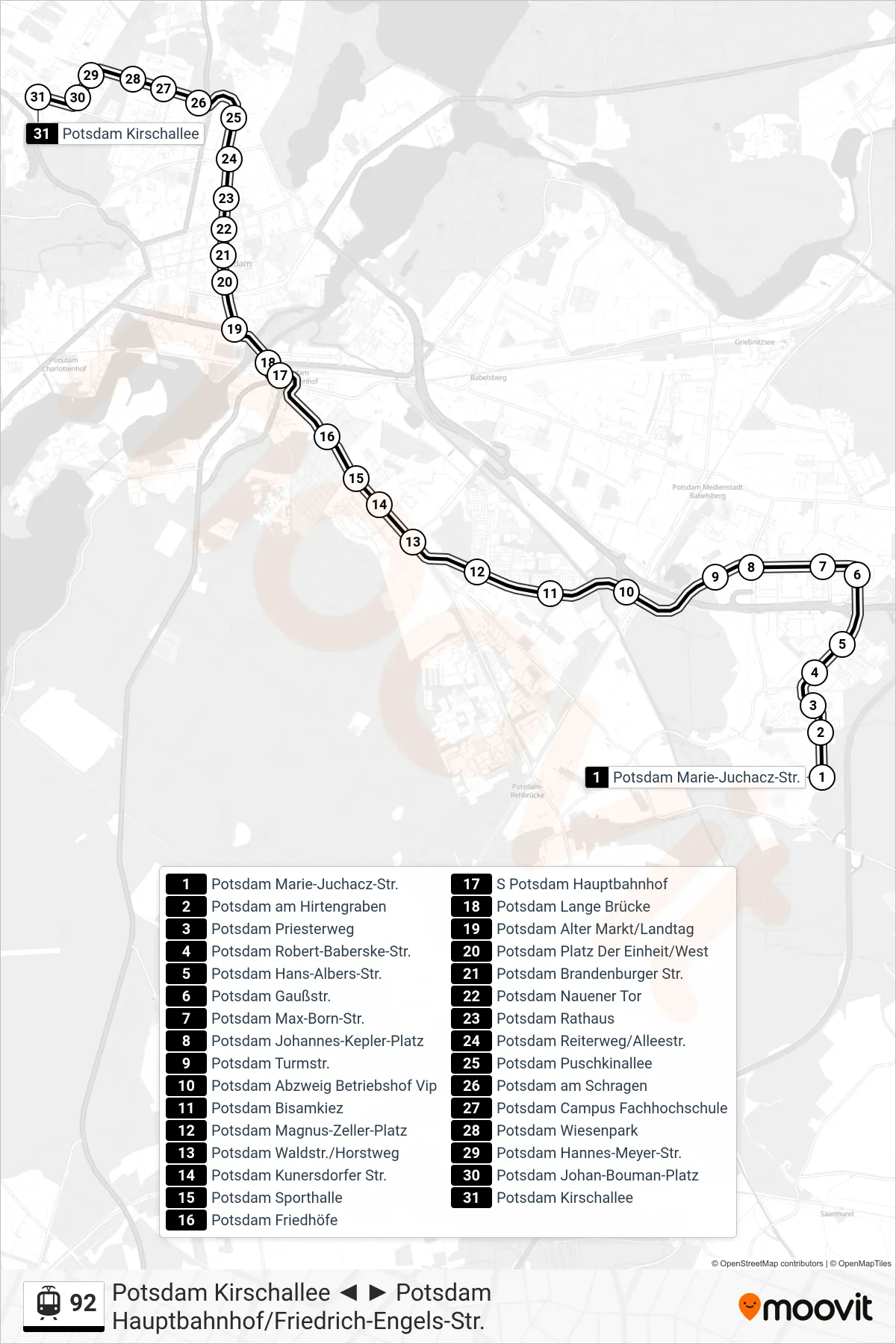
Stops list (92 - Potsdam Kirschallee)
- Potsdam Marie-Juchacz-Str.
- Potsdam am Hirtengraben
- Potsdam Priesterweg
- Potsdam Robert-Baberske-Str.
- Potsdam Hans-Albers-Str.
- Potsdam Gaußstr.
- Potsdam Max-Born-Str.
- Potsdam Johannes-Kepler-Platz
- Potsdam Turmstr.
- Potsdam Abzweig Betriebshof Vip
- Potsdam Bisamkiez
- Potsdam Magnus-Zeller-Platz
- Potsdam Waldstr./Horstweg
- Potsdam Kunersdorfer Str.
- Potsdam Sporthalle
- Potsdam Friedhöfe
- S Potsdam Hauptbahnhof
- Potsdam Lange Brücke
- Potsdam Alter Markt/Landtag
- Potsdam Platz Der Einheit/West
- Potsdam Brandenburger Str.
- Potsdam Nauener Tor
- Potsdam Rathaus
- Potsdam Reiterweg/Alleestr.
- Potsdam Puschkinallee
- Potsdam am Schragen
- Potsdam Campus Fachhochschule
- Potsdam Wiesenpark
- Potsdam Hannes-Meyer-Str.
- Potsdam Johan-Bouman-Platz
- Potsdam Kirschallee