
92 Bus Route Map
View the 92 route map and see all 92 stops along the route. The map of 92 shows where the bus travels and the location of each stop, making it easy to understand the entire route at a glance.
Explore Regional Transportation District routes on the map and see where Regional Transportation District bus services operate. Use the 92 map to find bus stops and see how the 92 connects different areas along its trip.
All 92 stops on the map are displayed in route order, helping you follow the 92 bus from the first stop to the last.
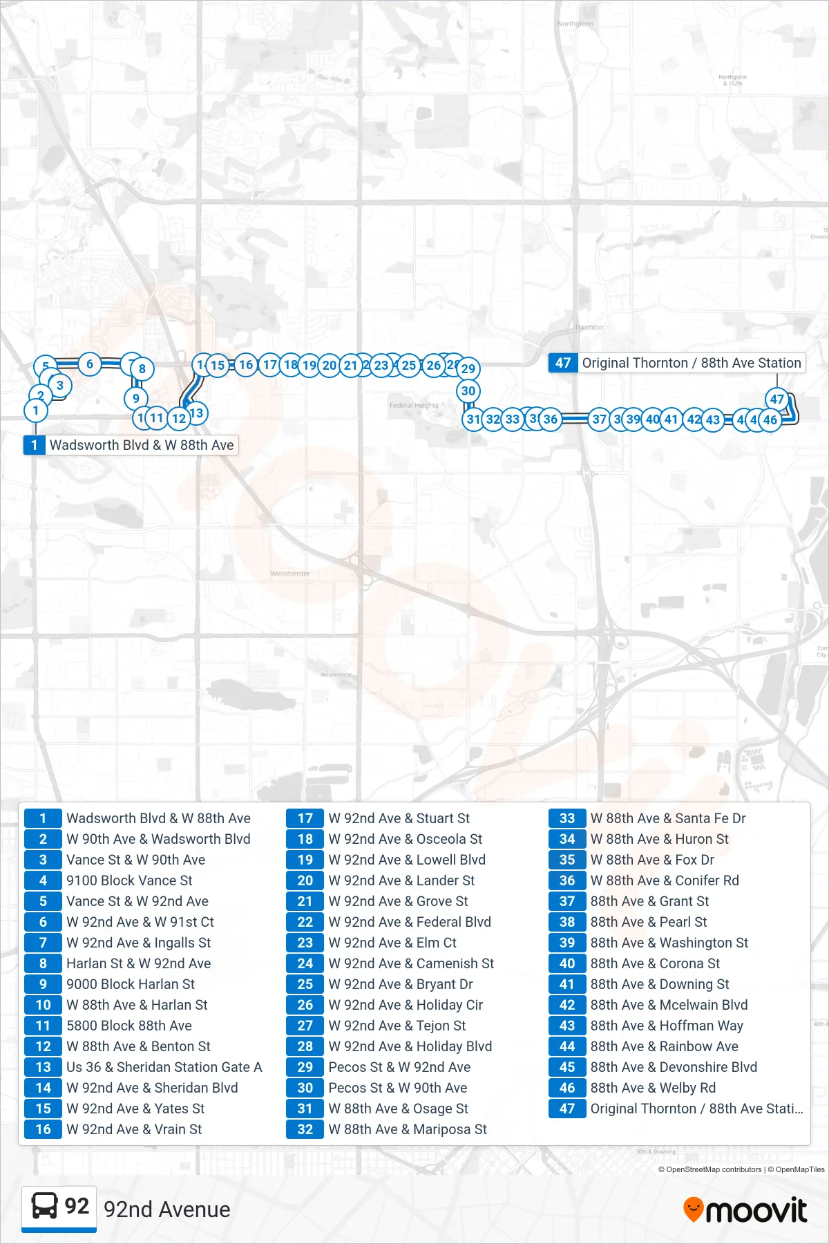
Stops list (92 - Original Thornton & 88th Ave Stn Via 92nd Ave)
- Wadsworth Blvd & W 88th Ave
- W 90th Ave & Wadsworth Blvd
- Vance St & W 90th Ave
- 9100 Block Vance St
- Vance St & W 92nd Ave
- W 92nd Ave & W 91st Ct
- W 92nd Ave & Ingalls St
- Harlan St & W 92nd Ave
- 9000 Block Harlan St
- W 88th Ave & Harlan St
- 5800 Block 88th Ave
- W 88th Ave & Benton St
- Us 36 & Sheridan Station Gate A
- W 92nd Ave & Sheridan Blvd
- W 92nd Ave & Yates St
- W 92nd Ave & Vrain St
- W 92nd Ave & Stuart St
- W 92nd Ave & Osceola St
- W 92nd Ave & Lowell Blvd
- W 92nd Ave & Lander St
- W 92nd Ave & Grove St
- W 92nd Ave & Federal Blvd
- W 92nd Ave & Elm Ct
- W 92nd Ave & Camenish St
- W 92nd Ave & Bryant Dr
- W 92nd Ave & Holiday Cir
- W 92nd Ave & Tejon St
- W 92nd Ave & Holiday Blvd
- Pecos St & W 92nd Ave
- Pecos St & W 90th Ave
- W 88th Ave & Osage St
- W 88th Ave & Mariposa St
- W 88th Ave & Santa Fe Dr
- W 88th Ave & Huron St
- W 88th Ave & Fox Dr
- W 88th Ave & Conifer Rd
- 88th Ave & Grant St
- 88th Ave & Pearl St
- 88th Ave & Washington St
- 88th Ave & Corona St
- 88th Ave & Downing St
- 88th Ave & Mcelwain Blvd
- 88th Ave & Hoffman Way
- 88th Ave & Rainbow Ave
- 88th Ave & Devonshire Blvd
- 88th Ave & Welby Rd
- Original Thornton / 88th Ave Station