
920 Bus Route Map
View the 920 route map and see all 920 stops along the route. The map of 920 shows where the bus travels and the location of each stop, making it easy to understand the entire route at a glance.
Explore DVG AG routes on the map and see where DVG AG bus services operate. Use the 920 map to find bus stops and see how the 920 connects different areas along its trip.
All 920 stops on the map are displayed in route order, helping you follow the 920 bus from the first stop to the last.
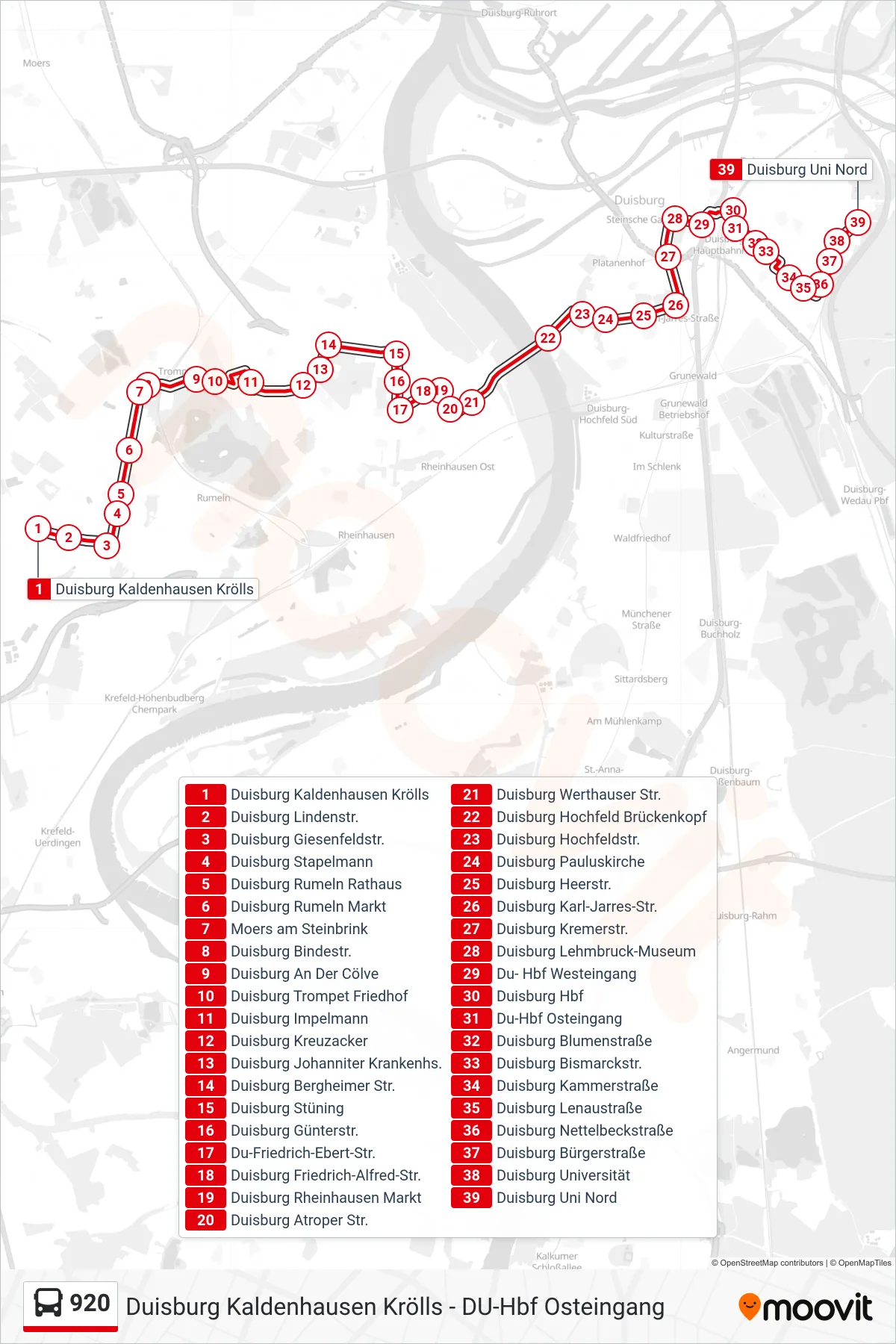
Stops list (920 - Duisburg Uni Nord)
- Duisburg Kaldenhausen Krölls
- Duisburg Lindenstr.
- Duisburg Giesenfeldstr.
- Duisburg Stapelmann
- Duisburg Rumeln Rathaus
- Duisburg Rumeln Markt
- Moers am Steinbrink
- Duisburg Bindestr.
- Duisburg An Der Cölve
- Duisburg Trompet Friedhof
- Duisburg Impelmann
- Duisburg Kreuzacker
- Duisburg Johanniter Krankenhs.
- Duisburg Bergheimer Str.
- Duisburg Stüning
- Duisburg Günterstr.
- Du-Friedrich-Ebert-Str.
- Duisburg Friedrich-Alfred-Str.
- Duisburg Rheinhausen Markt
- Duisburg Atroper Str.
- Duisburg Werthauser Str.
- Duisburg Hochfeld Brückenkopf
- Duisburg Hochfeldstr.
- Duisburg Pauluskirche
- Duisburg Heerstr.
- Duisburg Karl-Jarres-Str.
- Duisburg Kremerstr.
- Duisburg Lehmbruck-Museum
- Du- Hbf Westeingang
- Duisburg Hbf
- Du-Hbf Osteingang
- Duisburg Blumenstraße
- Duisburg Bismarckstr.
- Duisburg Kammerstraße
- Duisburg Lenaustraße
- Duisburg Nettelbeckstraße
- Duisburg Bürgerstraße
- Duisburg Universität
- Duisburg Uni Nord