
924 Bus Route Map
View the 924 route map and see all 924 stops along the route. The map of 924 shows where the bus travels and the location of each stop, making it easy to understand the entire route at a glance.
Explore DVG AG routes on the map and see where DVG AG bus services operate. Use the 924 map to find bus stops and see how the 924 connects different areas along its trip.
All 924 stops on the map are displayed in route order, helping you follow the 924 bus from the first stop to the last.
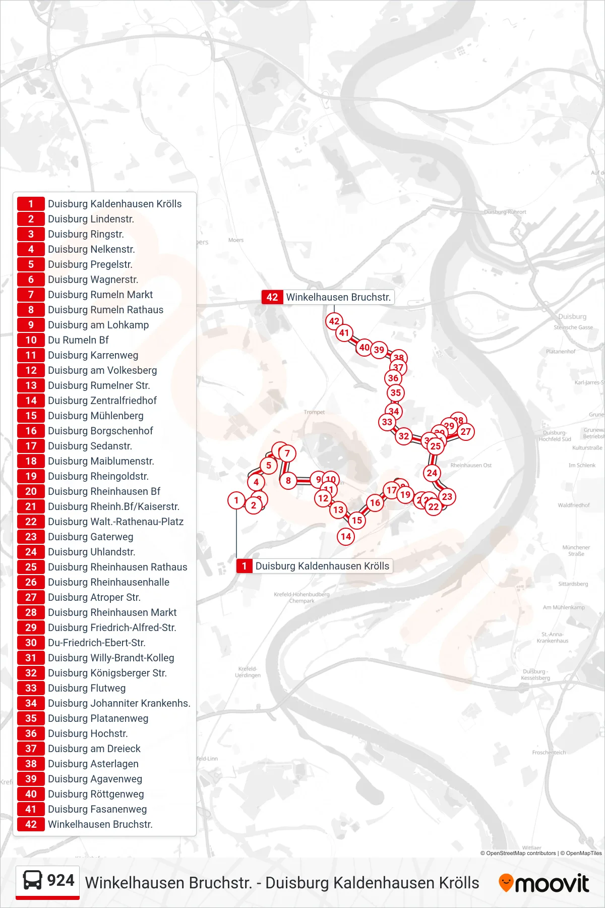
Stops list (924 - Winkelhausen Bruchstr.)
- Duisburg Kaldenhausen Krölls
- Duisburg Lindenstr.
- Duisburg Ringstr.
- Duisburg Nelkenstr.
- Duisburg Pregelstr.
- Duisburg Wagnerstr.
- Duisburg Rumeln Markt
- Duisburg Rumeln Rathaus
- Duisburg am Lohkamp
- Du Rumeln Bf
- Duisburg Karrenweg
- Duisburg am Volkesberg
- Duisburg Rumelner Str.
- Duisburg Zentralfriedhof
- Duisburg Mühlenberg
- Duisburg Borgschenhof
- Duisburg Sedanstr.
- Duisburg Maiblumenstr.
- Duisburg Rheingoldstr.
- Duisburg Rheinhausen Bf
- Duisburg Rheinh.Bf/Kaiserstr.
- Duisburg Walt.-Rathenau-Platz
- Duisburg Gaterweg
- Duisburg Uhlandstr.
- Duisburg Rheinhausen Rathaus
- Duisburg Rheinhausenhalle
- Duisburg Atroper Str.
- Duisburg Rheinhausen Markt
- Duisburg Friedrich-Alfred-Str.
- Du-Friedrich-Ebert-Str.
- Duisburg Willy-Brandt-Kolleg
- Duisburg Königsberger Str.
- Duisburg Flutweg
- Duisburg Johanniter Krankenhs.
- Duisburg Platanenweg
- Duisburg Hochstr.
- Duisburg am Dreieck
- Duisburg Asterlagen
- Duisburg Agavenweg
- Duisburg Röttgenweg
- Duisburg Fasanenweg
- Winkelhausen Bruchstr.