
929 Bus Route Map
View the 929 route map and see all 929 stops along the route. The map of 929 shows where the bus travels and the location of each stop, making it easy to understand the entire route at a glance.
Explore Niederrheinische VKB routes on the map and see where Niederrheinische VKB bus services operate. Use the 929 map to find bus stops and see how the 929 connects different areas along its trip.
All 929 stops on the map are displayed in route order, helping you follow the 929 bus from the first stop to the last.
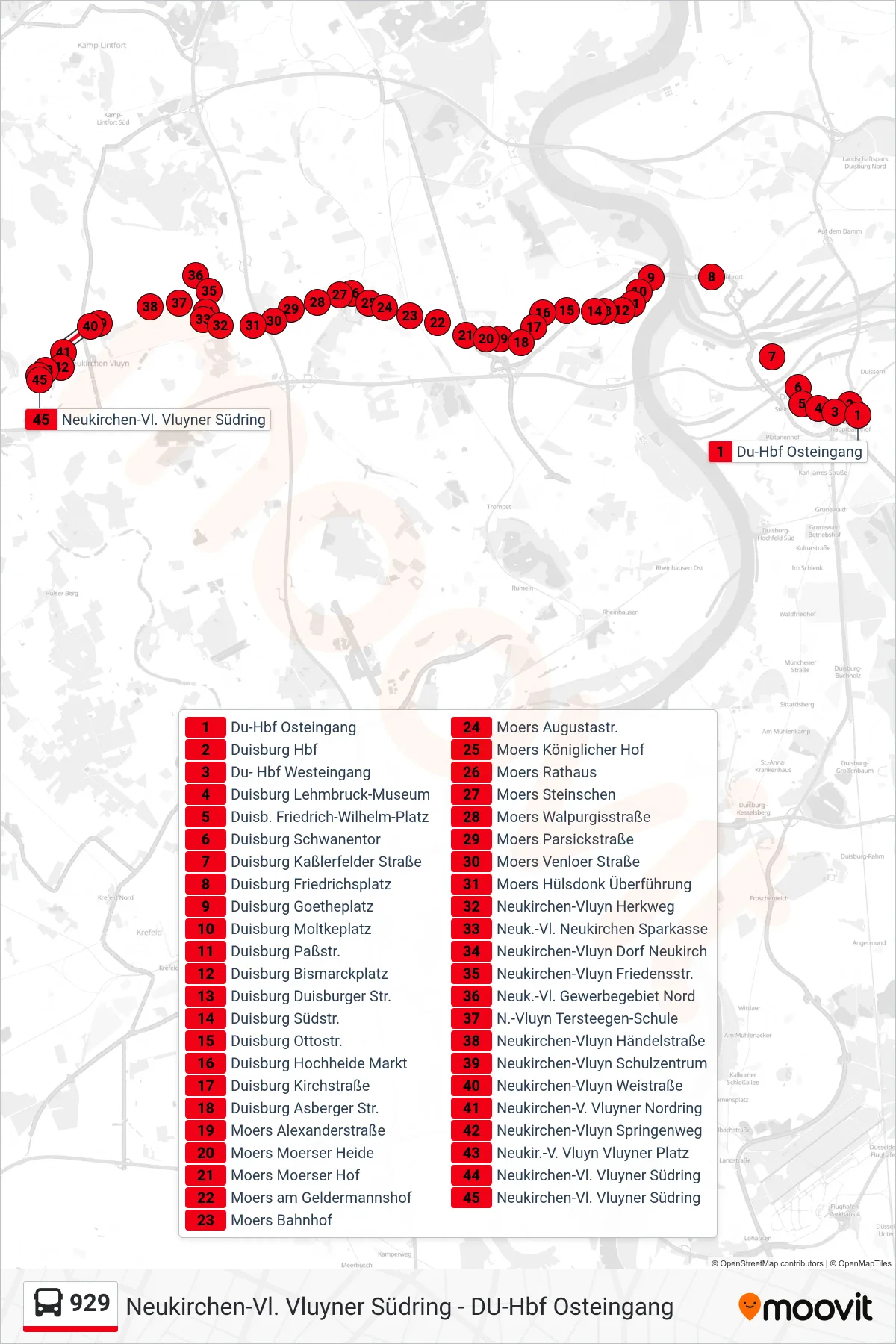
Stops list (929 - Neukirchen-Vl. Vluyner Südring)
- Du-Hbf Osteingang
- Duisburg Hbf
- Du- Hbf Westeingang
- Duisburg Lehmbruck-Museum
- Duisb. Friedrich-Wilhelm-Platz
- Duisburg Schwanentor
- Duisburg Kaßlerfelder Straße
- Duisburg Friedrichsplatz
- Duisburg Goetheplatz
- Duisburg Moltkeplatz
- Duisburg Paßstr.
- Duisburg Bismarckplatz
- Duisburg Duisburger Str.
- Duisburg Südstr.
- Duisburg Ottostr.
- Duisburg Hochheide Markt
- Duisburg Kirchstraße
- Duisburg Asberger Str.
- Moers Alexanderstraße
- Moers Moerser Heide
- Moers Moerser Hof
- Moers am Geldermannshof
- Moers Bahnhof
- Moers Augustastr.
- Moers Königlicher Hof
- Moers Rathaus
- Moers Steinschen
- Moers Walpurgisstraße
- Moers Parsickstraße
- Moers Venloer Straße
- Moers Hülsdonk Überführung
- Neukirchen-Vluyn Herkweg
- Neuk.-Vl. Neukirchen Sparkasse
- Neukirchen-Vluyn Dorf Neukirch
- Neukirchen-Vluyn Friedensstr.
- Neuk.-Vl. Gewerbegebiet Nord
- N.-Vluyn Tersteegen-Schule
- Neukirchen-Vluyn Händelstraße
- Neukirchen-Vluyn Schulzentrum
- Neukirchen-Vluyn Weistraße
- Neukirchen-V. Vluyner Nordring
- Neukirchen-Vluyn Springenweg
- Neukir.-V. Vluyn Vluyner Platz
- Neukirchen-Vl. Vluyner Südring
- Neukirchen-Vl. Vluyner Südring