
940 Bus Route Map
View the 940 route map and see all 940 stops along the route. The map of 940 shows where the bus travels and the location of each stop, making it easy to understand the entire route at a glance.
Explore DVG AG routes on the map and see where DVG AG bus services operate. Use the 940 map to find bus stops and see how the 940 connects different areas along its trip.
All 940 stops on the map are displayed in route order, helping you follow the 940 bus from the first stop to the last.
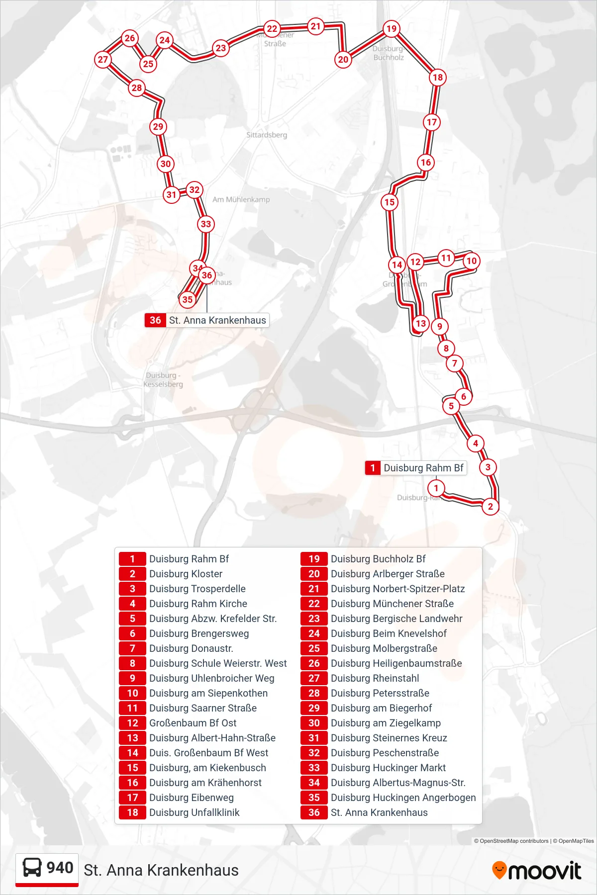
Stops list (940 - St. Anna Krankenhaus)
- Duisburg Rahm Bf
- Duisburg Kloster
- Duisburg Trosperdelle
- Duisburg Rahm Kirche
- Duisburg Abzw. Krefelder Str.
- Duisburg Brengersweg
- Duisburg Donaustr.
- Duisburg Schule Weierstr. West
- Duisburg Uhlenbroicher Weg
- Duisburg am Siepenkothen
- Duisburg Saarner Straße
- Großenbaum Bf Ost
- Duisburg Albert-Hahn-Straße
- Duis. Großenbaum Bf West
- Duisburg, am Kiekenbusch
- Duisburg am Krähenhorst
- Duisburg Eibenweg
- Duisburg Unfallklinik
- Duisburg Buchholz Bf
- Duisburg Arlberger Straße
- Duisburg Norbert-Spitzer-Platz
- Duisburg Münchener Straße
- Duisburg Bergische Landwehr
- Duisburg Beim Knevelshof
- Duisburg Molbergstraße
- Duisburg Heiligenbaumstraße
- Duisburg Rheinstahl
- Duisburg Petersstraße
- Duisburg am Biegerhof
- Duisburg am Ziegelkamp
- Duisburg Steinernes Kreuz
- Duisburg Peschenstraße
- Duisburg Huckinger Markt
- Duisburg Albertus-Magnus-Str.
- Duisburg Huckingen Angerbogen
- St. Anna Krankenhaus