
940 E Bus Route Map
View the 940 E route map and see all 940 E stops along the route. The map of 940 E shows where the bus travels and the location of each stop, making it easy to understand the entire route at a glance.
Explore DVG AG routes on the map and see where DVG AG bus services operate. Use the 940 E map to find bus stops and see how the 940 E connects different areas along its trip.
All 940 E stops on the map are displayed in route order, helping you follow the 940 E bus from the first stop to the last.
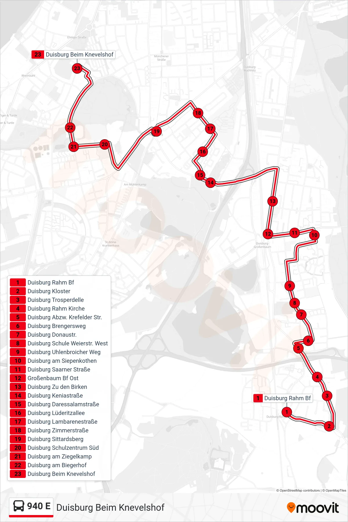
Stops list (940 E - Duisburg Beim Knevelshof)
- Duisburg Rahm Bf
- Duisburg Kloster
- Duisburg Trosperdelle
- Duisburg Rahm Kirche
- Duisburg Abzw. Krefelder Str.
- Duisburg Brengersweg
- Duisburg Donaustr.
- Duisburg Schule Weierstr. West
- Duisburg Uhlenbroicher Weg
- Duisburg am Siepenkothen
- Duisburg Saarner Straße
- Großenbaum Bf Ost
- Duisburg Zu den Birken
- Duisburg Keniastraße
- Duisburg Daressalamstraße
- Duisburg Lüderitzallee
- Duisburg Lambarenestraße
- Duisburg Zimmerstraße
- Duisburg Sittardsberg
- Duisburg Schulzentrum Süd
- Duisburg am Ziegelkamp
- Duisburg am Biegerhof
- Duisburg Beim Knevelshof
Change direction
- Route Map - 940 E - Duisburg Rahm Bf
- Route Map - 940 E - Duisburg Rahm Bf
- Route Map - 940 E - Duisburg Mannesmann Tor 2
- Route Map - 940 E - Du-Gesamtsch. Großenbaum
- Route Map - 940 E - Duisburg Schulzentrum Süd
- Route Map - 940 E - Du-Gesamtsch. Großenbaum
- Route Map - 940 E - Duisburg Blankenburger Straße
- Route Map - 940 E - Duisburg Eibenweg