
95 Bus Route Map
View the 95 route map and see all 95 stops along the route. The map of 95 shows where the bus travels and the location of each stop, making it easy to understand the entire route at a glance.
Explore Miami-Dade Transit routes on the map and see where Miami-Dade Transit bus services operate. Use the 95 map to find bus stops and see how the 95 connects different areas along its trip.
All 95 stops on the map are displayed in route order, helping you follow the 95 bus from the first stop to the last.
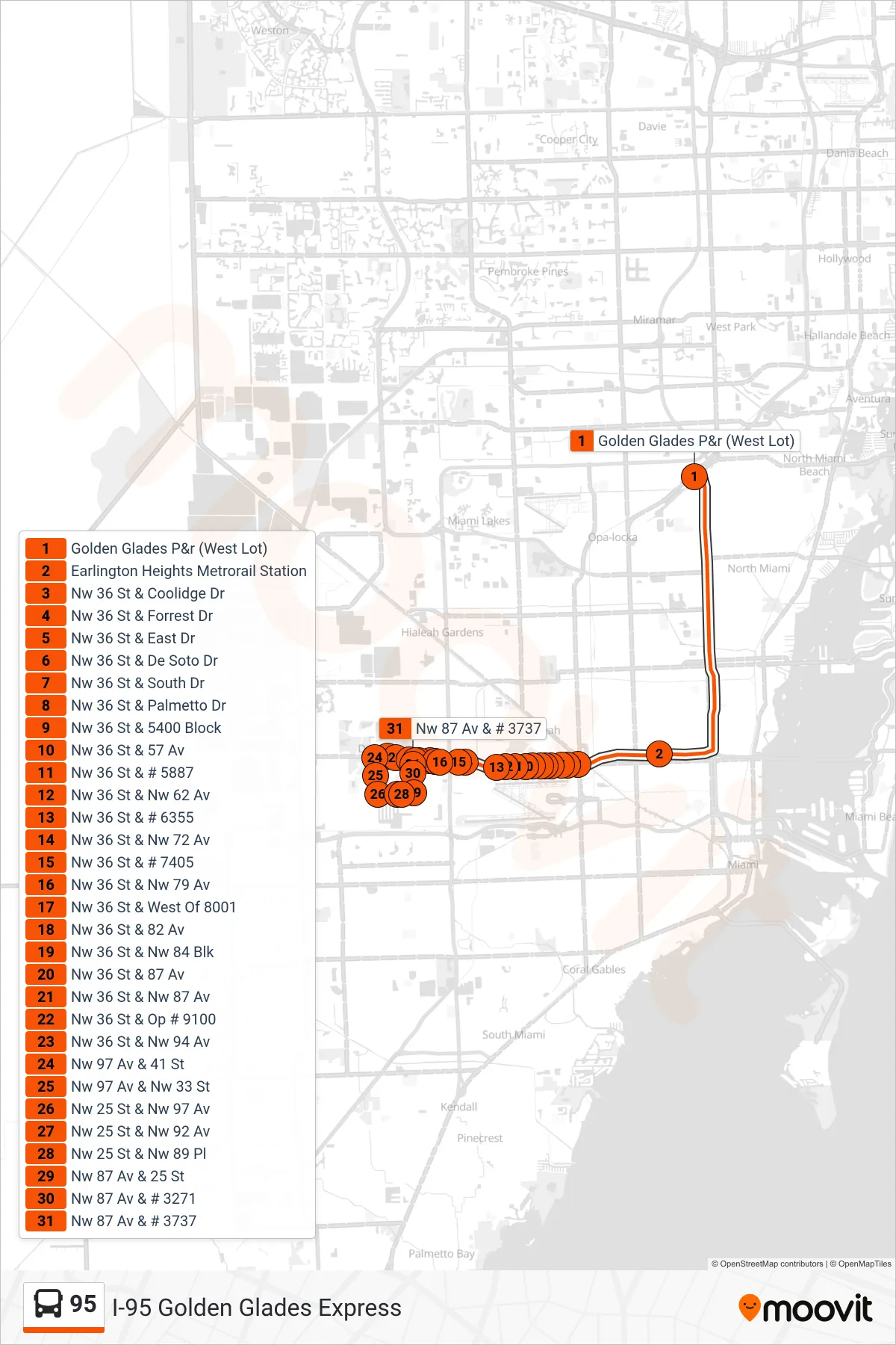
Stops list (95 - 95b - Doral)
- Golden Glades P&r (West Lot)
- Earlington Heights Metrorail Station
- Nw 36 St & Coolidge Dr
- Nw 36 St & Forrest Dr
- Nw 36 St & East Dr
- Nw 36 St & De Soto Dr
- Nw 36 St & South Dr
- Nw 36 St & Palmetto Dr
- Nw 36 St & 5400 Block
- Nw 36 St & 57 Av
- Nw 36 St & # 5887
- Nw 36 St & Nw 62 Av
- Nw 36 St & # 6355
- Nw 36 St & Nw 72 Av
- Nw 36 St & # 7405
- Nw 36 St & Nw 79 Av
- Nw 36 St & West Of 8001
- Nw 36 St & 82 Av
- Nw 36 St & Nw 84 Blk
- Nw 36 St & 87 Av
- Nw 36 St & Nw 87 Av
- Nw 36 St & Op # 9100
- Nw 36 St & Nw 94 Av
- Nw 97 Av & 41 St
- Nw 97 Av & Nw 33 St
- Nw 25 St & Nw 97 Av
- Nw 25 St & Nw 92 Av
- Nw 25 St & Nw 89 Pl
- Nw 87 Av & 25 St
- Nw 87 Av & # 3271
- Nw 87 Av & # 3737
Change direction
- Route Map - 95 - 95 - Golden Glades Park & Ride
- Route Map - 95 - 95a - Aventura Mall Terminal Via Golden Glades Park & Ride
- Route Map - 95 - 95 - Carol City Via Golden Glades Park & Ride
- Route Map - 95 - 95b - Golden Glades Park & Ride
- Route Map - 95 - 95a - Golden Glades Park & Ride
- Route Map - 95 - 95 - Downtown Miami
- Route Map - 95 - 95a - Civic Center Via Golden Glades Park & Ride
- Route Map - 95 - 95 - Golden Glades Pak & Ride
- Route Map - 95 - 95 - Downtown Miami Via Golden Glades Park & Ride
- Route Map - 95 - 95a - Civic Center