
97 Bus Route Map
View the 97 route map and see all 97 stops along the route. The map of 97 shows where the bus travels and the location of each stop, making it easy to understand the entire route at a glance.
Explore ALV Oberhessen routes on the map and see where ALV Oberhessen bus services operate. Use the 97 map to find bus stops and see how the 97 connects different areas along its trip.
All 97 stops on the map are displayed in route order, helping you follow the 97 bus from the first stop to the last.
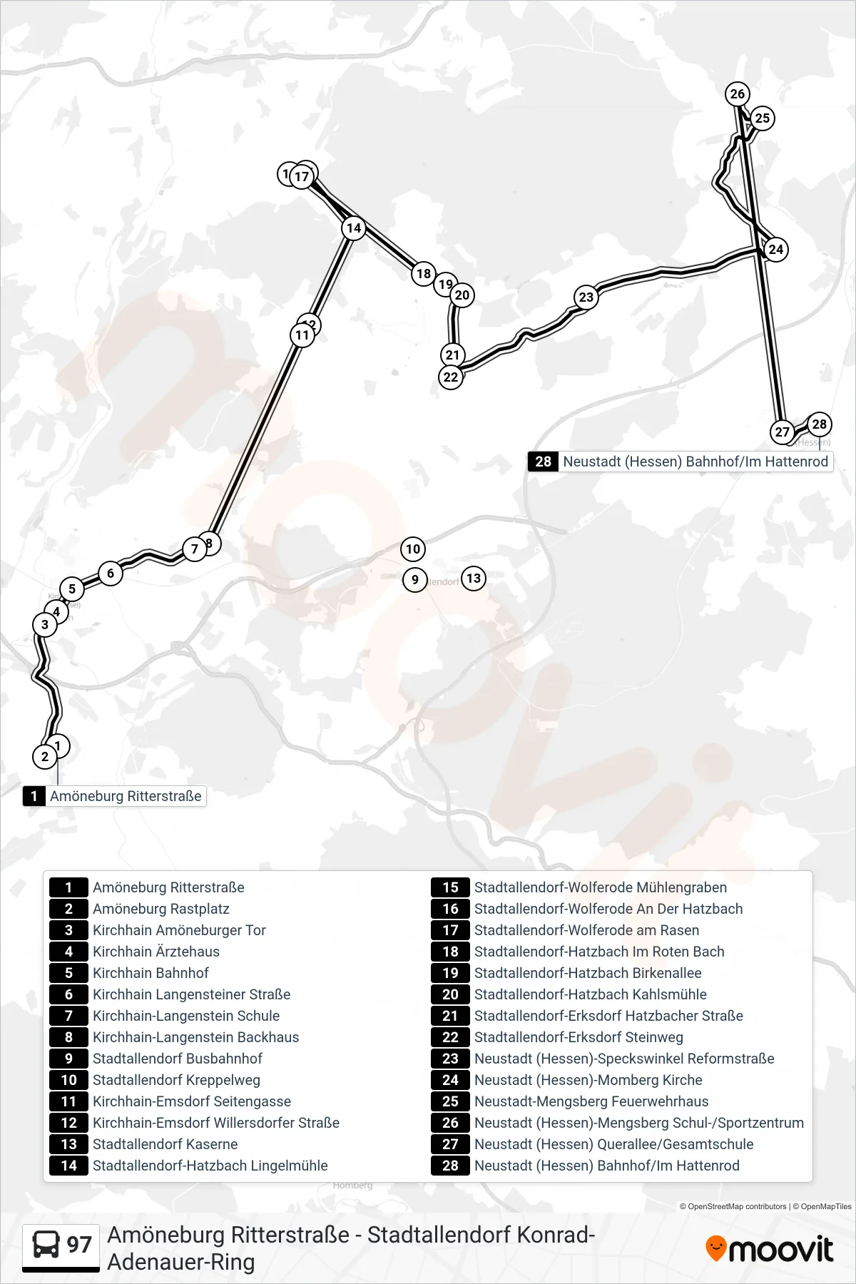
Stops list (97 - Neustadt (Hessen) Bahnhof/Im Hattenrod)
- Amöneburg Ritterstraße
- Amöneburg Rastplatz
- Kirchhain Amöneburger Tor
- Kirchhain Ärztehaus
- Kirchhain Bahnhof
- Kirchhain Langensteiner Straße
- Kirchhain-Langenstein Schule
- Kirchhain-Langenstein Backhaus
- Stadtallendorf Busbahnhof
- Stadtallendorf Kreppelweg
- Kirchhain-Emsdorf Seitengasse
- Kirchhain-Emsdorf Willersdorfer Straße
- Stadtallendorf Kaserne
- Stadtallendorf-Hatzbach Lingelmühle
- Stadtallendorf-Wolferode Mühlengraben
- Stadtallendorf-Wolferode An Der Hatzbach
- Stadtallendorf-Wolferode am Rasen
- Stadtallendorf-Hatzbach Im Roten Bach
- Stadtallendorf-Hatzbach Birkenallee
- Stadtallendorf-Hatzbach Kahlsmühle
- Stadtallendorf-Erksdorf Hatzbacher Straße
- Stadtallendorf-Erksdorf Steinweg
- Neustadt (Hessen)-Speckswinkel Reformstraße
- Neustadt (Hessen)-Momberg Kirche
- Neustadt-Mengsberg Feuerwehrhaus
- Neustadt (Hessen)-Mengsberg Schul-/Sportzentrum
- Neustadt (Hessen) Querallee/Gesamtschule
- Neustadt (Hessen) Bahnhof/Im Hattenrod
Change direction
- Route Map - 97 - Neustadt (Hessen) Mozartstraße
- Route Map - 97 - Neustadt (Hessen)-Mengsberg Schul-/Sportzentrum
- Route Map - 97 - Kirchhain Bahnhof
- Route Map - 97 - Amöneburg Ritterstraße
- Route Map - 97 - Stadtallendorf-Wolferode Mühlengraben
- Route Map - 97 - Stadtallendorf Konrad-Adenauer-Ring
- Route Map - 97 - Stadtallendorf-Erksdorf Allendorfer Grund