
978 Bus Route Map
View the 978 route map and see all 978 stops along the route. The map of 978 shows where the bus travels and the location of each stop, making it easy to understand the entire route at a glance.
Explore LB 7 Schütt VGN 252 - 2541 routes on the map and see where LB 7 Schütt VGN 252 - 2541 bus services operate. Use the 978 map to find bus stops and see how the 978 connects different areas along its trip.
All 978 stops on the map are displayed in route order, helping you follow the 978 bus from the first stop to the last.
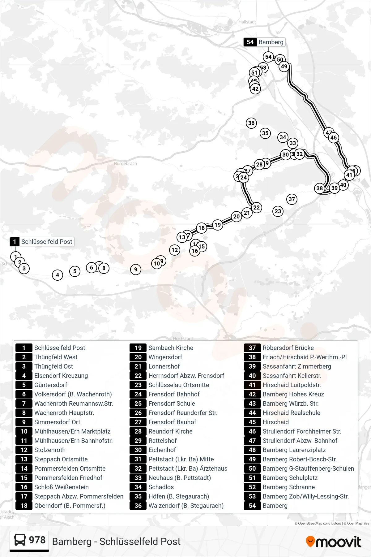
Stops list (978 - Bamberg)
- Schlüsselfeld Post
- Thüngfeld West
- Thüngfeld Ost
- Elsendorf Kreuzung
- Güntersdorf
- Volkersdorf (B. Wachenroth)
- Wachenroth Reumannsw.Str.
- Wachenroth Hauptstr.
- Simmersdorf Ort
- Mühlhausen/Erh Marktplatz
- Mühlhausen/Erh Bahnhofstr.
- Stolzenroth
- Steppach Ortsmitte
- Pommersfelden Ortsmitte
- Pommersfelden Friedhof
- Schloß Weißenstein
- Steppach Abzw. Pommersfelden
- Oberndorf (B. Pommersf.)
- Sambach Kirche
- Wingersdorf
- Lonnershof
- Herrnsdorf Abzw. Frensdorf
- Schlüsselau Ortsmitte
- Frensdorf Bahnhof
- Frensdorf Schule
- Frensdorf Reundorfer Str.
- Frensdorf Bauhof
- Reundorf Kirche
- Rattelshof
- Eichenhof
- Pettstadt (Lkr. Ba) Mitte
- Pettstadt (Lkr. Ba) Ärztehaus
- Neuhaus (B. Pettstadt)
- Schadlos
- Höfen (B. Stegaurach)
- Waizendorf (B. Stegaurach)
- Röbersdorf Brücke
- Erlach/Hirschaid P.-Werthm.-Pl
- Sassanfahrt Zimmerberg
- Sassanfahrt Kellerstr.
- Hirschaid Luitpoldstr.
- Bamberg Hohes Kreuz
- Bamberg Würzb. Str.
- Hirschaid Realschule
- Hirschaid
- Strullendorf Forchheimer Str.
- Strullendorf Abzw. Bahnhof
- Bamberg Laurenziplatz
- Bamberg Robert-Bosch-Str.
- Bamberg G-Stauffenberg-Schulen
- Bamberg Schulplatz
- Bamberg Schranne
- Bamberg Zob/Willy-Lessing-Str.
- Bamberg