
TRANSFER Bus Route Map
View the TRANSFER route map and see all TRANSFER stops along the route. The map of TRANSFER shows where the bus travels and the location of each stop, making it easy to understand the entire route at a glance.
Explore Transfer Soc. Cons. a.r.l. routes on the map and see where Transfer Soc. Cons. a.r.l. bus services operate. Use the TRANSFER map to find bus stops and see how the TRANSFER connects different areas along its trip.
All TRANSFER stops on the map are displayed in route order, helping you follow the TRANSFER bus from the first stop to the last.
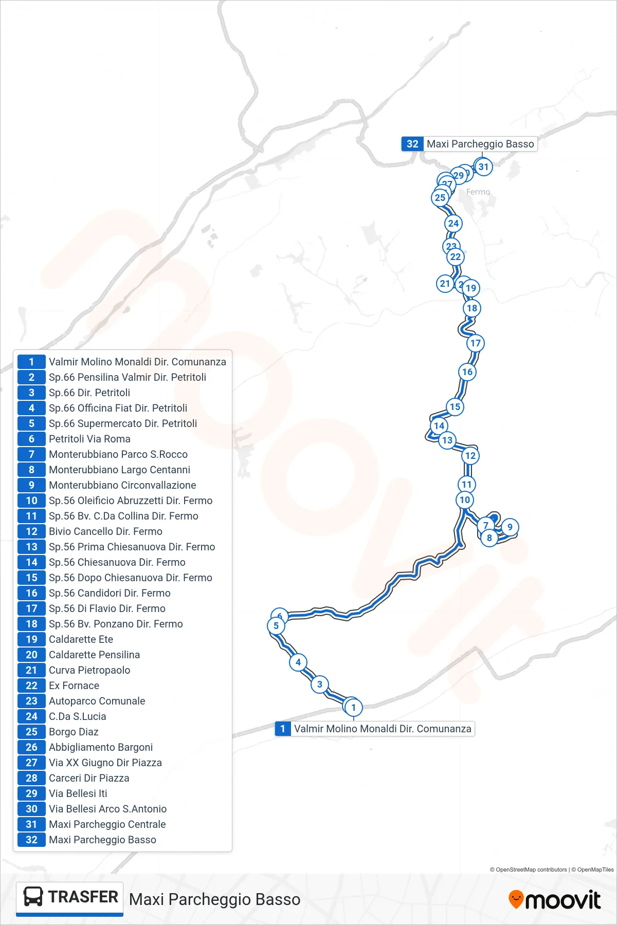
Stops list (TRANSFER - Lower Maximum Parking)
- Valmir Molino Monaldi To Comunanza
- Provincial Road 66 Valmir Shelter Dir. Petritoli
- SP66 Towards Petritoli
- SP66 Fiat Garage Petritoli Direction
- Supermarket 66 Towards Petritoli
- Petritoli Via Roma
- Monterubbiano San Rocco Park
- Monterubbiano Largo Centanni
- Monterubbiano Ring Road
- Provincial Road 56 Abruzzetti Oil Mill Fermo Direction
- Provincial Road 56 Collina District Fermo Direction
- Gate Junction Fermo Direction
- Route 56 Before Chiesanuova Towards Fermo
- SP.56 Chiesanuova Towards Fermo
- SP56 Past Chiesanuova Towards Fermo
- SP56 Candidori Fermo Direction
- SP.56 Di Flavio Towards Fermo
- Route 56 Junction Ponzano Towards Fermo
- Caldarette Ete
- Caldarette Shelter
- Pietropaolo Curve
- Former Furnace
- Municipal Parking Lot
- Santa Lucia District
- Borgo Diaz
- Bargoni Clothing
- XX June Street Towards Square
- Prison to Square
- Bellesi Street ITI
- Bellesi Street St. Anthony Arch
- Central Maxi Parking
- Lower Maximum Parking
Change direction
- Route Map - TRASFER - Rubbianello Bar Gedi Towards Valmir
- Route Map - TRASFER - Valmir Molino Monaldi To Comunanza
- Route Map - TRASFER - Petritoli Via Roma
- Route Map - TRASFER - Valmir Molino Monaldi Dir. Pedaso
- Route Map - TRASFER - Rubbianello Bar Gedi To Pedaso
- Route Map - TRASFER - Marina Altidona SP85 SS16 Junction
- Route Map - TRASFER - Central Maxi Parking
- Route Map - TRASFER - Pedaso Kindergarten Dir. Rubbianello
- Route Map - TRASFER - Amandola Montefortino Junction
- Route Map - TRASFER - Montalto Marche To Montedinove
- Route Map - TRASFER - Monterubbiano San Rocco Park
- Route Map - TRASFER - Comunanza Terminal
- Route Map - TRASFER - Corridoni Street