
A Bus Route Map
View the A route map and see all A stops along the route. The map of A shows where the bus travels and the location of each stop, making it easy to understand the entire route at a glance.
Explore Start routes on the map and see where Start bus services operate. Use the A map to find bus stops and see how the A connects different areas along its trip.
All A stops on the map are displayed in route order, helping you follow the A bus from the first stop to the last.
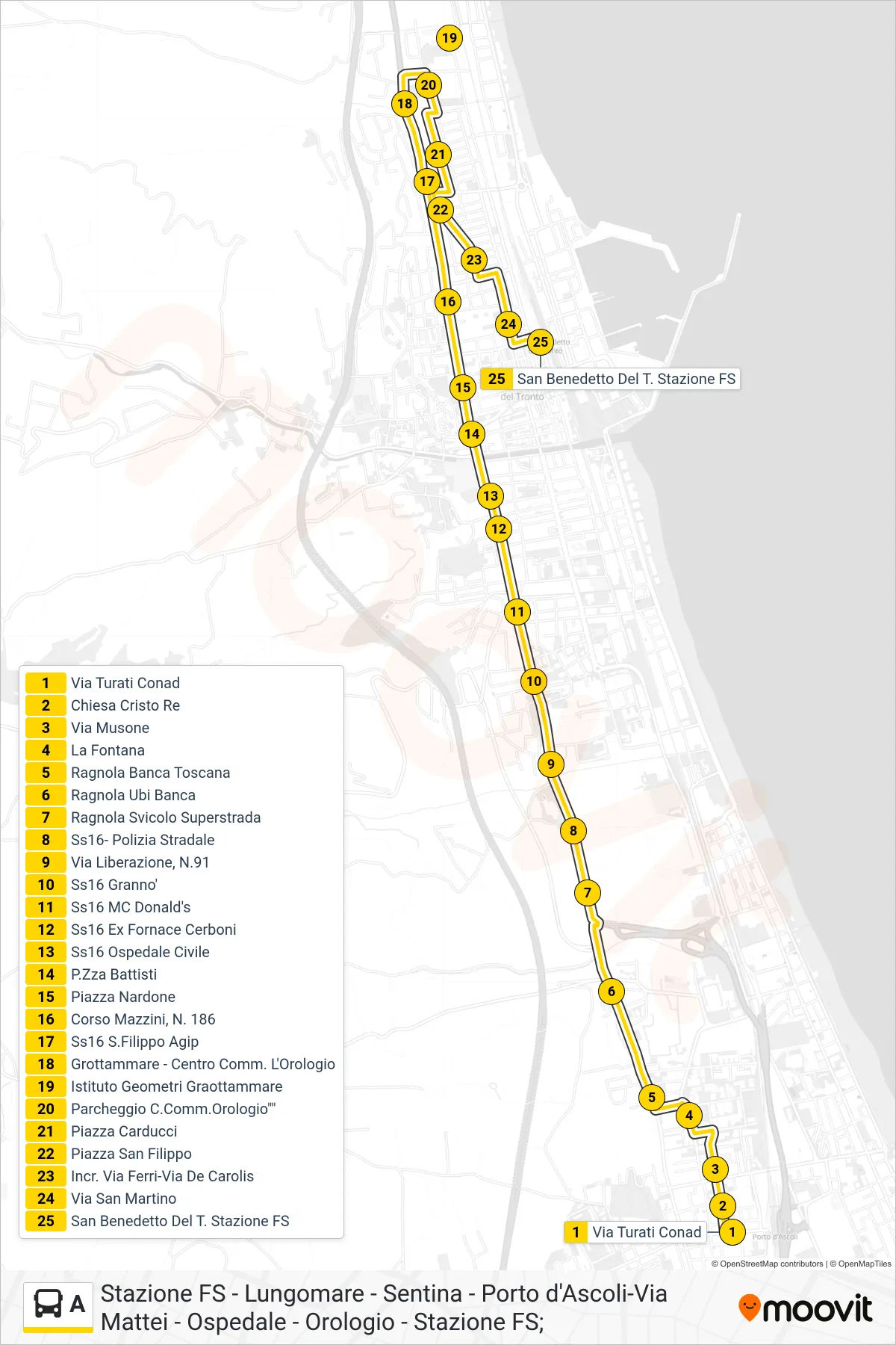
Stops list (A - San Benedetto Del Tronto Train Station)
- Via Turati Conad
- Christ the King Church
- Musone Street
- La Fontana
- Ragnola Banca Toscana
- Ragnola UBI Bank
- Ragnola Highway Junction
- SS16 - State Police
- Liberation Street, No.91
- State Road 16 Grannò
- Highway 16 McDonald's
- SS16 Former Cerboni Factory
- SS16 Civil Hospital
- Battisti Square
- Piazza Nardone
- 186 Mazzini Avenue
- SS16 San Filippo Agip
- Grottammare - L'Orologio Shopping Center
- Grottammare Surveyors Institute
- Clock Shopping Center Parking
- Carducci Square
- Saint Philip Square
- Intersection Via Ferri-Via De Carolis
- San Martino Street
- San Benedetto Del Tronto Train Station