
A Bus Route Map
View the A route map and see all A stops along the route. The map of A shows where the bus travels and the location of each stop, making it easy to understand the entire route at a glance.
Explore SAVIT routes on the map and see where SAVIT bus services operate. Use the A map to find bus stops and see how the A connects different areas along its trip.
All A stops on the map are displayed in route order, helping you follow the A bus from the first stop to the last.
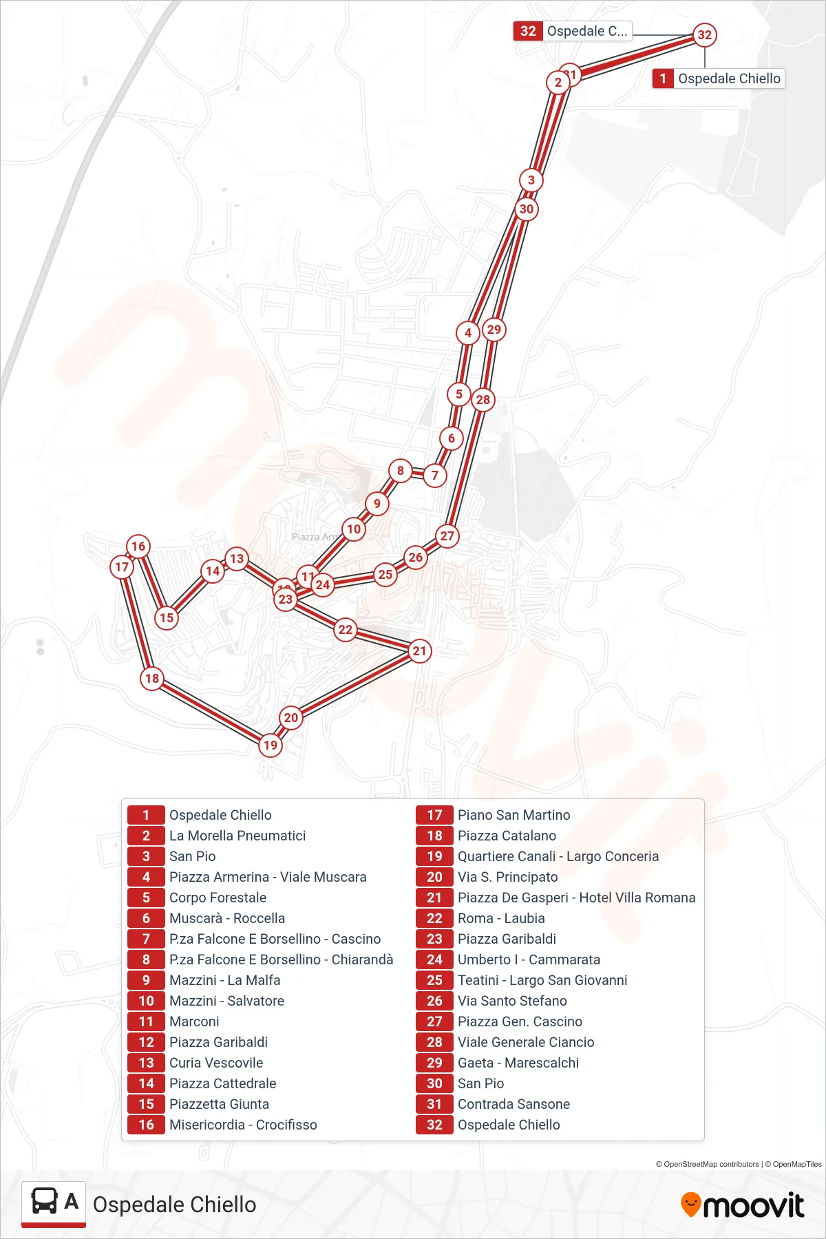
Stops list (A - Chiello Hospital)
- Chiello Hospital
- La Morella Tires
- Saint Pio
- Piazza Armerina - Viale Muscara
- Forestry Corps
- Muscara - Roccella
- Falcone And Borsellino Square - Cascino
- Falcone and Borsellino Square - Chiarandà
- Mazzini - La Malfa
- Mazzini - Salvatore
- Marconi
- Garibaldi Square
- Diocesan Curia
- Cathedral Square
- Piazzetta Giunta
- Misericordia - Crucifix
- Piano San Martino
- Piazza Catalano
- Canali District - Conceria Square
- Via S. Principato
- De Gasperi Square - Hotel Villa Romana
- Roma - Laubia
- Garibaldi Square
- Umberto I - Cammarata
- Teatini - San Giovanni Square
- Santo Stefano Street
- General Cascino Square
- General Ciancio Avenue
- Gaeta - Marescalchi
- Saint Pio
- Sansone District
- Chiello Hospital