
A Subway Route Map
View the A route map and see all A stops along the route. The map of A shows where the subway travels and the location of each stop, making it easy to understand the entire route at a glance.
Explore MTA Subway routes on the map and see where MTA Subway subway services operate. Use the A map to find subway stations and see how the A connects different areas along its trip.
All A stops on the map are displayed in route order, helping you follow the A subway from the first station to the last.
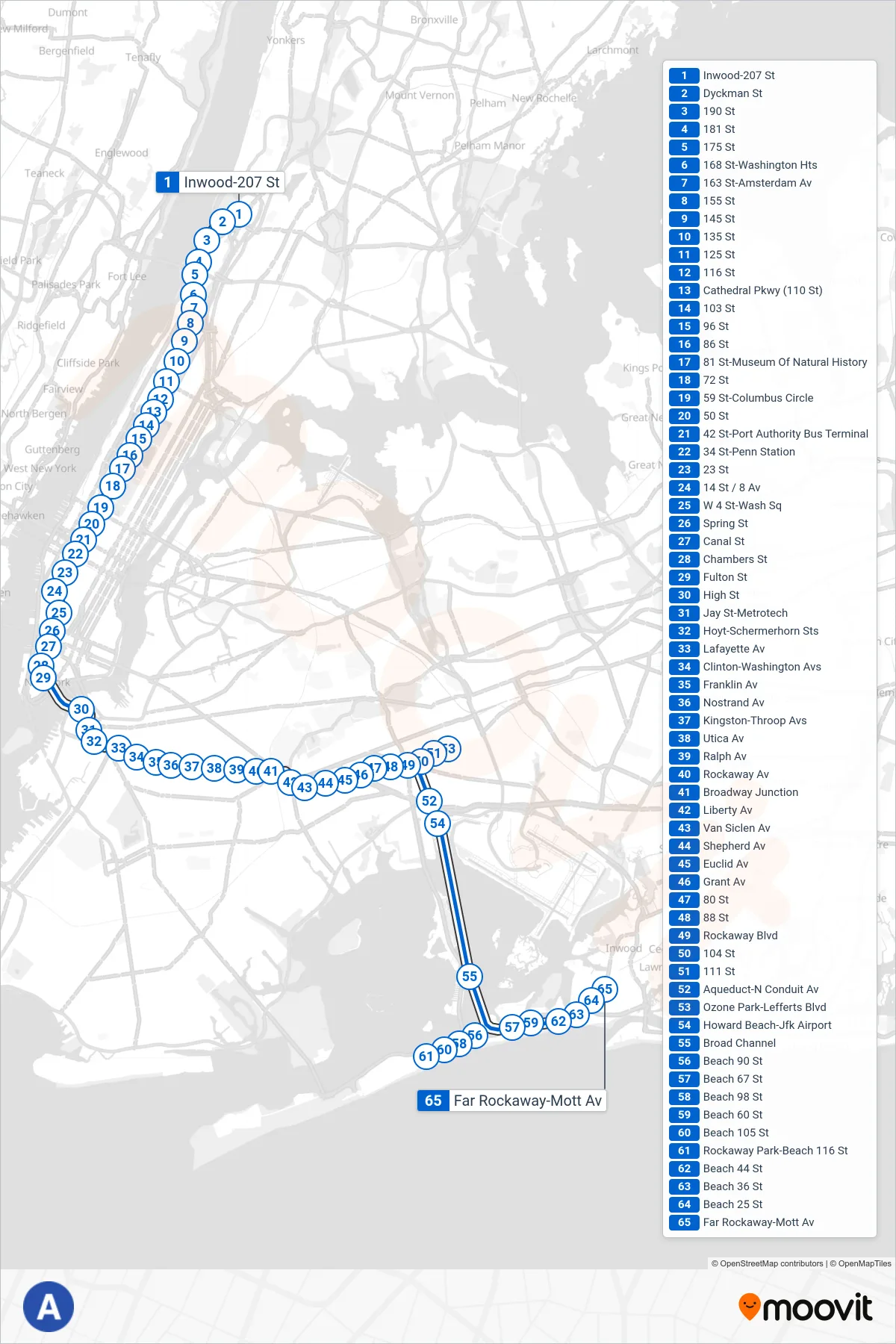
Stops list (A - Downtown & Far Rockaway)
- Inwood-207 St
- Dyckman St
- 190 St
- 181 St
- 175 St
- 168 St-Washington Hts
- 163 St-Amsterdam Av
- 155 St
- 145 St
- 135 St
- 125 St
- 116 St
- Cathedral Pkwy (110 St)
- 103 St
- 96 St
- 86 St
- 81 St-Museum Of Natural History
- 72 St
- 59 St-Columbus Circle
- 50 St
- 42 St-Port Authority Bus Terminal
- 34 St-Penn Station
- 23 St
- 14 St / 8 Av
- W 4 St-Wash Sq
- Spring St
- Canal St
- Chambers St
- Fulton St
- High St
- Jay St-Metrotech
- Hoyt-Schermerhorn Sts
- Lafayette Av
- Clinton-Washington Avs
- Franklin Av
- Nostrand Av
- Kingston-Throop Avs
- Utica Av
- Ralph Av
- Rockaway Av
- Broadway Junction
- Liberty Av
- Van Siclen Av
- Shepherd Av
- Euclid Av
- Grant Av
- 80 St
- 88 St
- Rockaway Blvd
- 104 St
- 111 St
- Aqueduct-N Conduit Av
- Ozone Park-Lefferts Blvd
- Howard Beach-Jfk Airport
- Broad Channel
- Beach 90 St
- Beach 67 St
- Beach 98 St
- Beach 60 St
- Beach 105 St
- Rockaway Park-Beach 116 St
- Beach 44 St
- Beach 36 St
- Beach 25 St
- Far Rockaway-Mott Av