
A Tram Route Map
View the A route map and see all A stops along the route. The map of A shows where the tram travels and the location of each stop, making it easy to understand the entire route at a glance.
Explore routes on the map and see where tram services operate. Use the A map to find tram stations and see how the A connects different areas along its trip.
All A stops on the map are displayed in route order, helping you follow the A tram from the first station to the last.
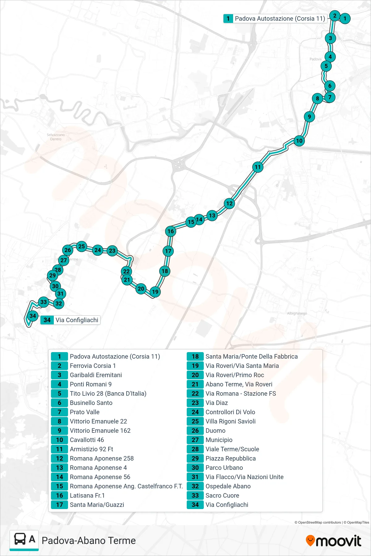
Stops list (A - Padova Bus Station > Giarre > Abano Configliachi)
- Padua Bus Station (Platform 11)
- Railway Track 1
- Garibaldi Eremitani
- Roman Bridges 9
- Tito Livio 28 (Bank of Italy)
- Santo Businello
- Prato Valle
- Vittorio Emanuele 22
- Vittorio Emanuele 162
- Cavallotti 46
- Armistizio 92 Ft
- Romana Aponense 258
- Romana Aponense 4
- Romana Aponense 56
- Romana Aponense Corner Castelfranco F.T.
- Latisana Fr.1
- Santa Maria/Guazzi
- Santa Maria/Ponte Della Fabbrica
- Via Roveri/Via Santa Maria
- Via Roveri/Primo Roc
- Abano Terme, Via Roveri
- Roman Street - Railway Station
- Diaz Street
- Flight Controllers
- Villa Rigoni Savioli
- Duomo
- City Hall
- Terme Avenue/Schools
- Republic Square
- Urban Park
- Via Flacco/United Nations Street
- Abano Hospital
- Sacred Heart
- Configliachi Street
Change direction
- Route Map - A - Padova Bus Station > Monteortone Terminal
- Route Map - A - Padua > Mandria San Daniele > Abano Configliachi
- Route Map - A - Padua Bus Station > Abano Sacred Heart
- Route Map - A - Abano Configliachi to Padua Bus Station
- Route Map - A - Monteortone Terminal > Padua Bus Station
- Route Map - A - Padua Garibaldi Eremitani > Giarre > Abano Town Hall
- Route Map - A - Turri Terminal > Padova Bus Station
- Route Map - A - Abano Hotel School > Padua Bus Station