
A Cable Car Route Map
View the A route map and see all A stops along the route. The map of A shows where the cable car travels and the location of each stop, making it easy to understand the entire route at a glance.
Explore Portland Streetcar routes on the map and see where Portland Streetcar cable car services operate. Use the A map to find cable car stations and see how the A connects different areas along its trip.
All A stops on the map are displayed in route order, helping you follow the A cable car from the first station to the last.
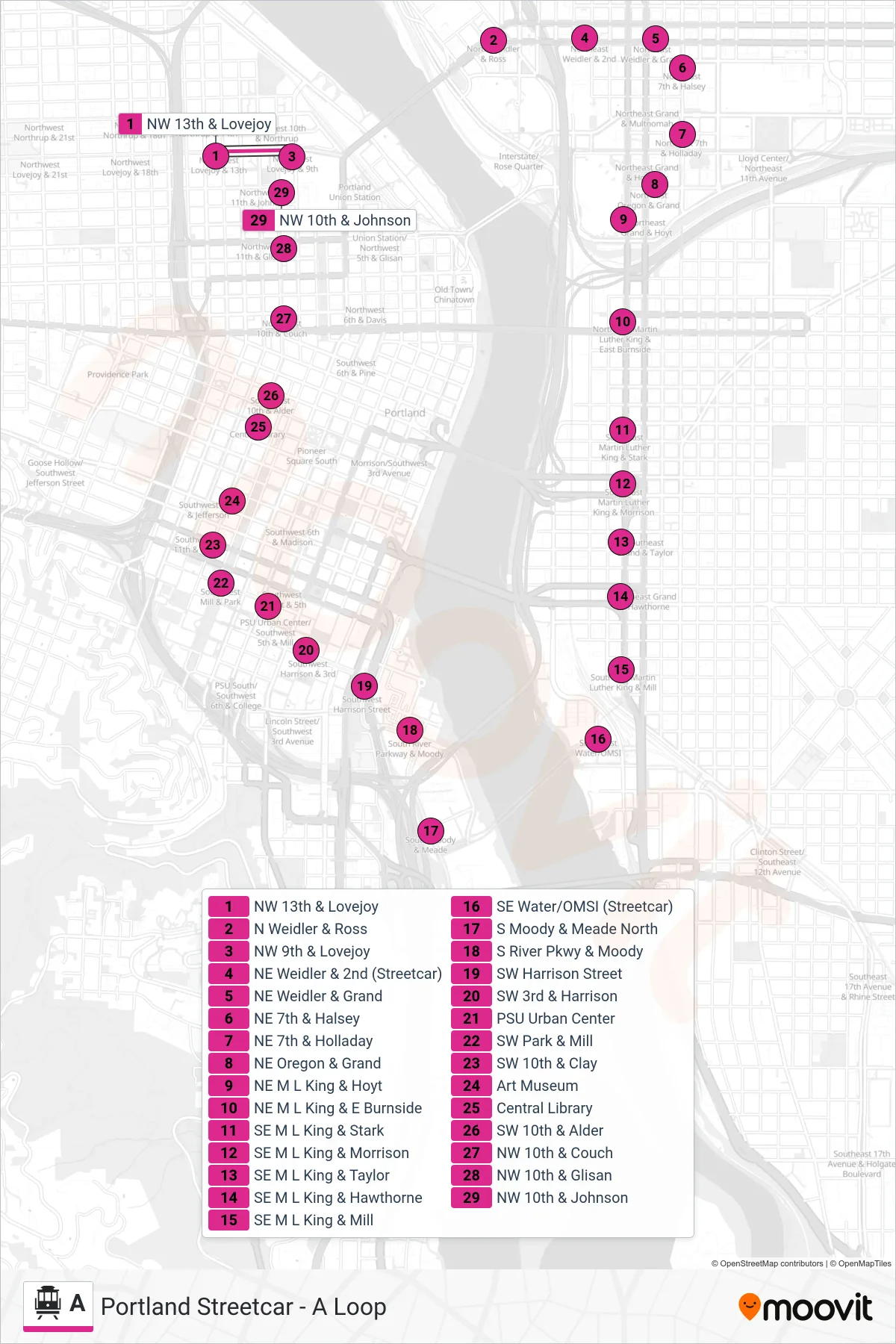
Stops list (A - NW 9th & Lovejoy)
- NW 13th & Lovejoy
- N Weidler & Ross
- NW 9th & Lovejoy
- NE Weidler & 2nd (Streetcar)
- NE Weidler & Grand
- NE 7th & Halsey
- NE 7th & Holladay
- NE Oregon & Grand
- NE M L King & Hoyt
- NE M L King & E Burnside
- SE M L King & Stark
- SE M L King & Morrison
- SE M L King & Taylor
- SE M L King & Hawthorne
- SE M L King & Mill
- SE Water/OMSI (Streetcar)
- S Moody & Meade North
- S River Pkwy & Moody
- SW Harrison Street
- SW 3rd & Harrison
- PSU Urban Center
- SW Park & Mill
- SW 10th & Clay
- Art Museum
- Central Library
- SW 10th & Alder
- NW 10th & Couch
- NW 10th & Glisan
- NW 10th & Johnson