
A Bus Route Map
View the A route map and see all A stops along the route. The map of A shows where the bus travels and the location of each stop, making it easy to understand the entire route at a glance.
Explore Chapel Hill Transit routes on the map and see where Chapel Hill Transit bus services operate. Use the A map to find bus stops and see how the A connects different areas along its trip.
All A stops on the map are displayed in route order, helping you follow the A bus from the first stop to the last.
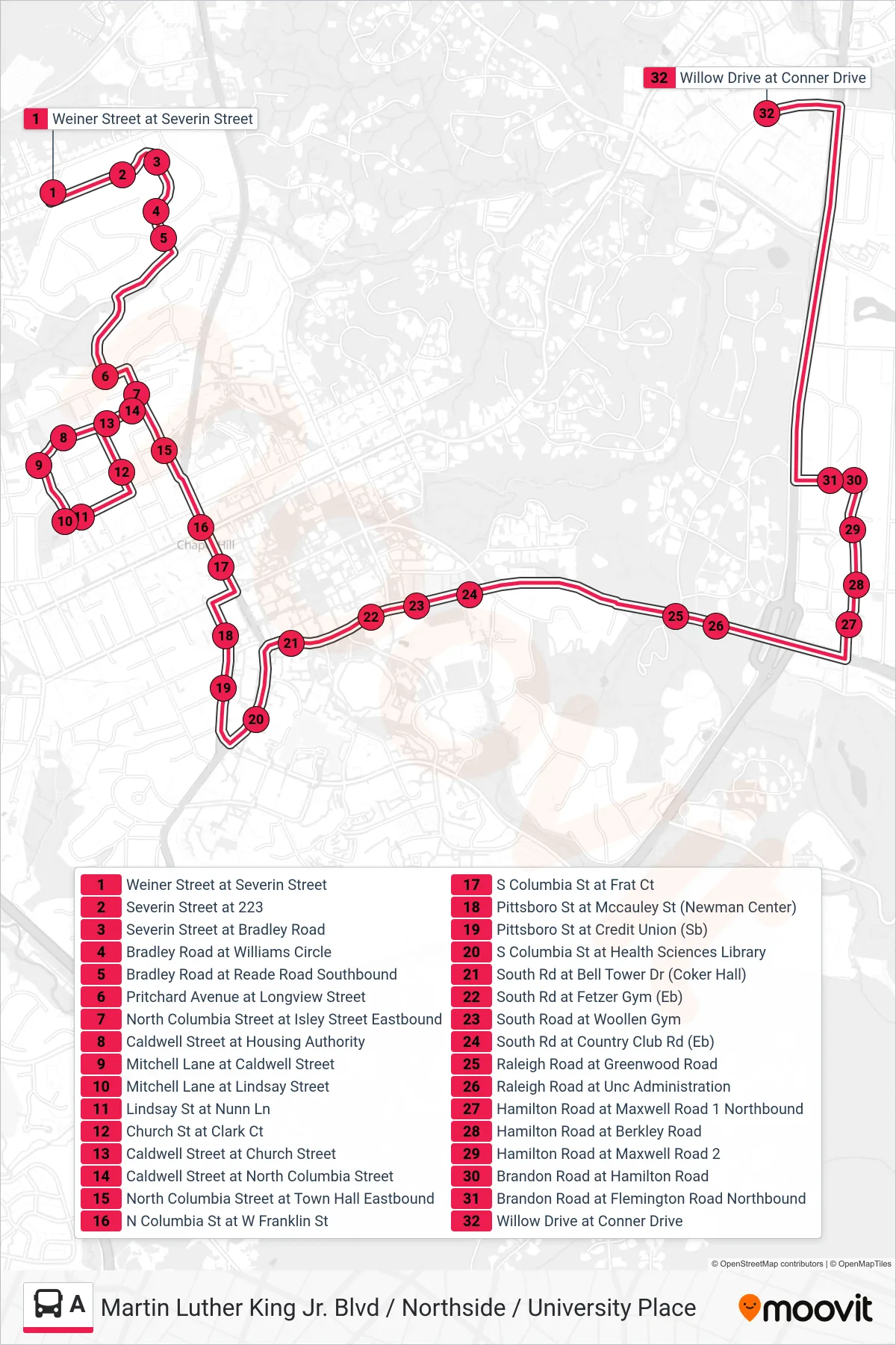
Stops list (A - Weiner Street at Severin Street→Willow Drive at Conner Drive)
- Weiner Street at Severin Street
- Severin Street at 223
- Severin Street at Bradley Road
- Bradley Road at Williams Circle
- Bradley Road at Reade Road Southbound
- Pritchard Avenue at Longview Street
- North Columbia Street at Isley Street Eastbound
- Caldwell Street at Housing Authority
- Mitchell Lane at Caldwell Street
- Mitchell Lane at Lindsay Street
- Lindsay St at Nunn Ln
- Church St at Clark Ct
- Caldwell Street at Church Street
- Caldwell Street at North Columbia Street
- North Columbia Street at Town Hall Eastbound
- N Columbia St at W Franklin St
- S Columbia St at Frat Ct
- Pittsboro St at Mccauley St (Newman Center)
- Pittsboro St at Credit Union (Sb)
- S Columbia St at Health Sciences Library
- South Rd at Bell Tower Dr (Coker Hall)
- South Rd at Fetzer Gym (Eb)
- South Road at Woollen Gym
- South Rd at Country Club Rd (Eb)
- Raleigh Road at Greenwood Road
- Raleigh Road at Unc Administration
- Hamilton Road at Maxwell Road 1 Northbound
- Hamilton Road at Berkley Road
- Hamilton Road at Maxwell Road 2
- Brandon Road at Hamilton Road
- Brandon Road at Flemington Road Northbound
- Willow Drive at Conner Drive