
A Bus Route Map
View the A route map and see all A stops along the route. The map of A shows where the bus travels and the location of each stop, making it easy to understand the entire route at a glance.
Explore IVB und Stubaitalbahn GmbH routes on the map and see where IVB und Stubaitalbahn GmbH bus services operate. Use the A map to find bus stops and see how the A connects different areas along its trip.
All A stops on the map are displayed in route order, helping you follow the A bus from the first stop to the last.
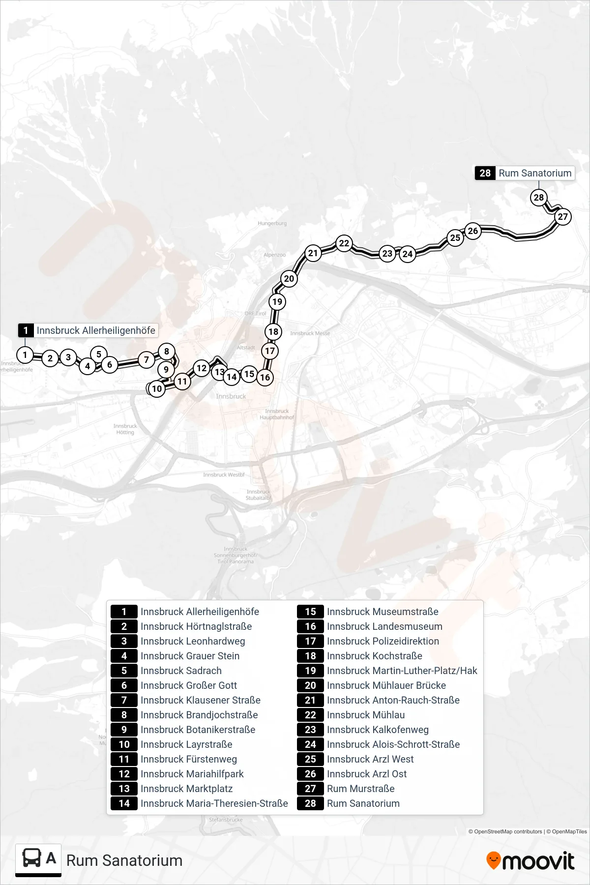
Stops list (A - Rum Sanatorium)
- Innsbruck Allerheiligenhöfe
- Innsbruck Hörtnaglstraße
- Innsbruck Leonhardweg
- Innsbruck Grauer Stein
- Innsbruck Sadrach
- Innsbruck Großer Gott
- Innsbruck Klausener Straße
- Innsbruck Brandjochstraße
- Innsbruck Botanikerstraße
- Innsbruck Layrstraße
- Innsbruck Fürstenweg
- Innsbruck Mariahilfpark
- Innsbruck Marktplatz
- Innsbruck Maria-Theresien-Straße
- Innsbruck Museumstraße
- Innsbruck Landesmuseum
- Innsbruck Polizeidirektion
- Innsbruck Kochstraße
- Innsbruck Martin-Luther-Platz/Hak
- Innsbruck Mühlauer Brücke
- Innsbruck Anton-Rauch-Straße
- Innsbruck Mühlau
- Innsbruck Kalkofenweg
- Innsbruck Alois-Schrott-Straße
- Innsbruck Arzl West
- Innsbruck Arzl Ost
- Rum Murstraße
- Rum Sanatorium