
A11 Bus Route Map
View the A11 route map and see all A11 stops along the route. The map of A11 shows where the bus travels and the location of each stop, making it easy to understand the entire route at a glance.
Explore WMATA routes on the map and see where WMATA bus services operate. Use the A11 map to find bus stops and see how the A11 connects different areas along its trip.
All A11 stops on the map are displayed in route order, helping you follow the A11 bus from the first stop to the last.
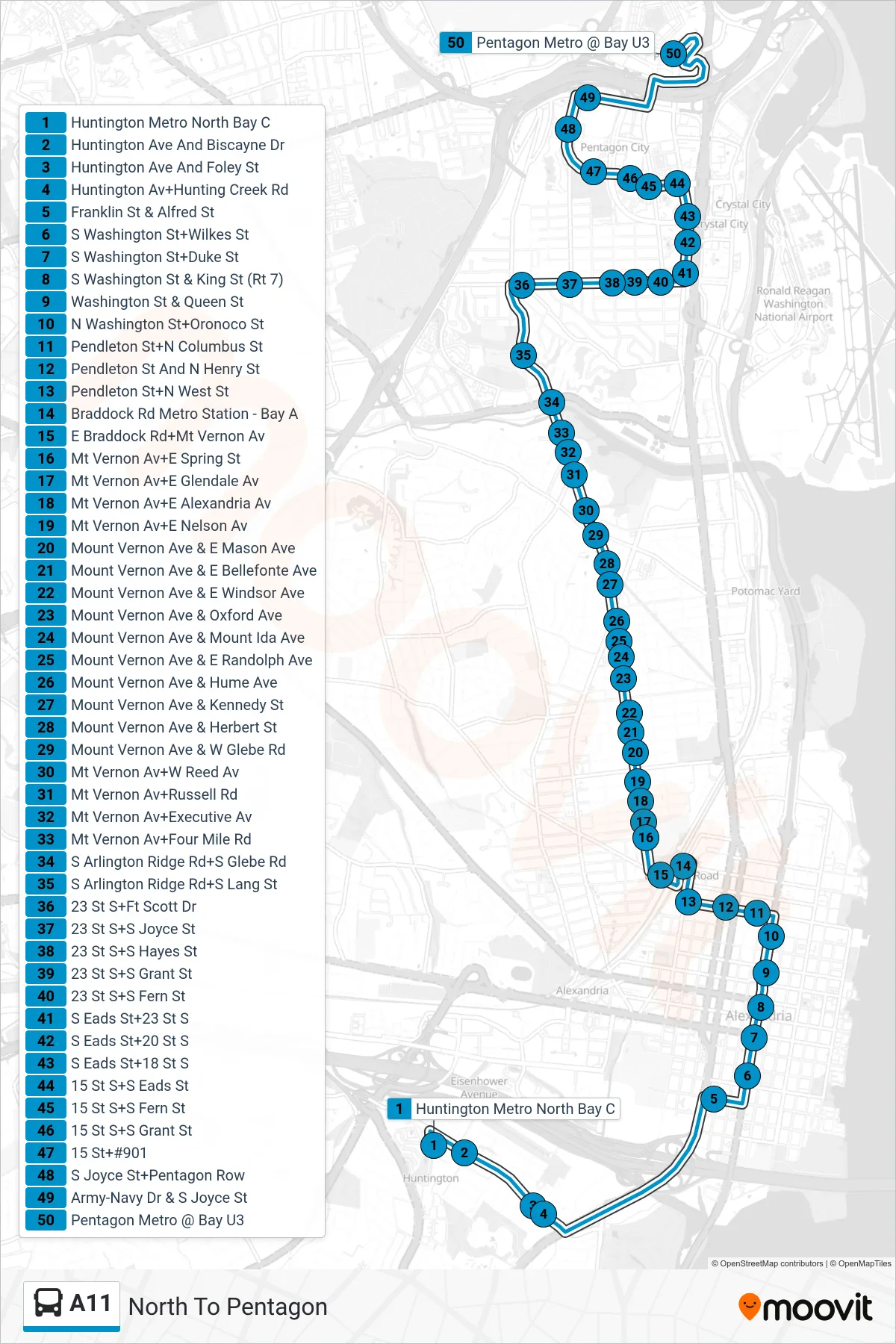
Stops list (A11 - North To Pentagon)
- Huntington Metro North Bay C
- Huntington Ave And Biscayne Dr
- Huntington Ave And Foley St
- Huntington Av+Hunting Creek Rd
- Franklin St & Alfred St
- S Washington St+Wilkes St
- S Washington St+Duke St
- S Washington St & King St (Rt 7)
- Washington St & Queen St
- N Washington St+Oronoco St
- Pendleton St+N Columbus St
- Pendleton St And N Henry St
- Pendleton St+N West St
- Braddock Rd Metro Station - Bay A
- E Braddock Rd+Mt Vernon Av
- Mt Vernon Av+E Spring St
- Mt Vernon Av+E Glendale Av
- Mt Vernon Av+E Alexandria Av
- Mt Vernon Av+E Nelson Av
- Mount Vernon Ave & E Mason Ave
- Mount Vernon Ave & E Bellefonte Ave
- Mount Vernon Ave & E Windsor Ave
- Mount Vernon Ave & Oxford Ave
- Mount Vernon Ave & Mount Ida Ave
- Mount Vernon Ave & E Randolph Ave
- Mount Vernon Ave & Hume Ave
- Mount Vernon Ave & Kennedy St
- Mount Vernon Ave & Herbert St
- Mount Vernon Ave & W Glebe Rd
- Mt Vernon Av+W Reed Av
- Mt Vernon Av+Russell Rd
- Mt Vernon Av+Executive Av
- Mt Vernon Av+Four Mile Rd
- S Arlington Ridge Rd+S Glebe Rd
- S Arlington Ridge Rd+S Lang St
- 23 St S+Ft Scott Dr
- 23 St S+S Joyce St
- 23 St S+S Hayes St
- 23 St S+S Grant St
- 23 St S+S Fern St
- S Eads St+23 St S
- S Eads St+20 St S
- S Eads St+18 St S
- 15 St S+S Eads St
- 15 St S+S Fern St
- 15 St S+S Grant St
- 15 St+#901
- S Joyce St+Pentagon Row
- Army-Navy Dr & S Joyce St
- Pentagon Metro @ Bay U3