
A382 Bus Route Map
View the A382 route map and see all A382 stops along the route. The map of A382 shows where the bus travels and the location of each stop, making it easy to understand the entire route at a glance.
Explore Verkehrsbetriebe Westfalen-Süd routes on the map and see where Verkehrsbetriebe Westfalen-Süd bus services operate. Use the A382 map to find bus stops and see how the A382 connects different areas along its trip.
All A382 stops on the map are displayed in route order, helping you follow the A382 bus from the first stop to the last.
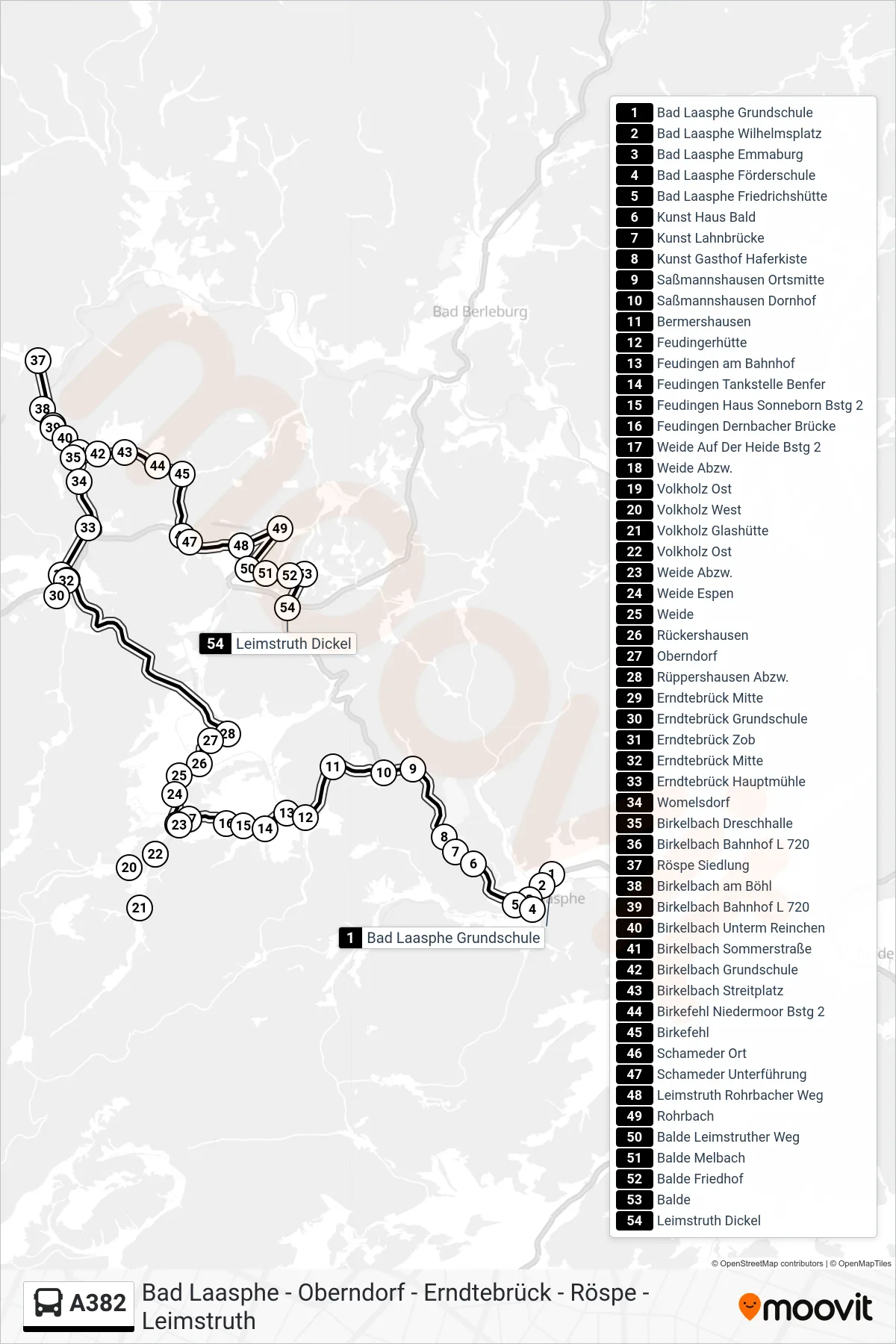
Stops list (A382 - Leimstruth Dickel)
- Bad Laasphe Grundschule
- Bad Laasphe Wilhelmsplatz
- Bad Laasphe Emmaburg
- Bad Laasphe Förderschule
- Bad Laasphe Friedrichshütte
- Kunst Haus Bald
- Kunst Lahnbrücke
- Kunst Gasthof Haferkiste
- Saßmannshausen Ortsmitte
- Saßmannshausen Dornhof
- Bermershausen
- Feudingerhütte
- Feudingen am Bahnhof
- Feudingen Tankstelle Benfer
- Feudingen Haus Sonneborn Bstg 2
- Feudingen Dernbacher Brücke
- Weide Auf Der Heide Bstg 2
- Weide Abzw.
- Volkholz Ost
- Volkholz West
- Volkholz Glashütte
- Volkholz Ost
- Weide Abzw.
- Weide Espen
- Weide
- Rückershausen
- Oberndorf
- Rüppershausen Abzw.
- Erndtebrück Mitte
- Erndtebrück Grundschule
- Erndtebrück Zob
- Erndtebrück Mitte
- Erndtebrück Hauptmühle
- Womelsdorf
- Birkelbach Dreschhalle
- Birkelbach Bahnhof L 720
- Röspe Siedlung
- Birkelbach am Böhl
- Birkelbach Bahnhof L 720
- Birkelbach Unterm Reinchen
- Birkelbach Sommerstraße
- Birkelbach Grundschule
- Birkelbach Streitplatz
- Birkefehl Niedermoor Bstg 2
- Birkefehl
- Schameder Ort
- Schameder Unterführung
- Leimstruth Rohrbacher Weg
- Rohrbach
- Balde Leimstruther Weg
- Balde Melbach
- Balde Friedhof
- Balde
- Leimstruth Dickel