
A40 Bus Route Map
View the A40 route map and see all A40 stops along the route. The map of A40 shows where the bus travels and the location of each stop, making it easy to understand the entire route at a glance.
Explore WMATA routes on the map and see where WMATA bus services operate. Use the A40 map to find bus stops and see how the A40 connects different areas along its trip.
All A40 stops on the map are displayed in route order, helping you follow the A40 bus from the first stop to the last.
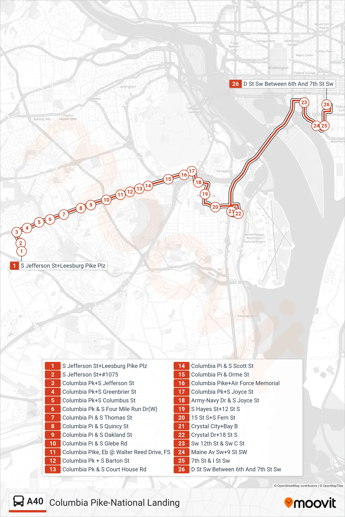
Stops list (A40 - East To L'Enfant Plaza)
- S Jefferson St+Leesburg Pike Plz
- S Jefferson St+#1075
- Columbia Pk+S Jefferson St
- Columbia Pk+S Greenbrier St
- Columbia Pk+S Columbus St
- Columbia Pk & S Four Mile Run Dr(W)
- Columbia Pi & S Thomas St
- Columbia Pi & S Quincy St
- Columbia Pi & S Oakland St
- Columbia Pi & S Glebe Rd
- Columbia Pike, Eb @ Walter Reed Drive, FS
- Columbia Pk + S Barton St
- Columbia Pk & S Court House Rd
- Columbia Pi & S Scott St
- Columbia Pi & Orme St
- Columbia Pike+Air Force Memorial
- Columbia Pk+S Joyce St
- Army-Navy Dr & S Joyce St
- S Hayes St+12 St S
- 15 St S+S Fern St
- Crystal City+Bay B
- Crystal Dr+18 St S
- Sw 12th St & Sw C St
- Maine Av Sw+9 St SW
- 7th St & I St Sw
- D St Sw Between 6th And 7th St Sw