
A71 Bus Route Map
View the A71 route map and see all A71 stops along the route. The map of A71 shows where the bus travels and the location of each stop, making it easy to understand the entire route at a glance.
Explore WMATA routes on the map and see where WMATA bus services operate. Use the A71 map to find bus stops and see how the A71 connects different areas along its trip.
All A71 stops on the map are displayed in route order, helping you follow the A71 bus from the first stop to the last.
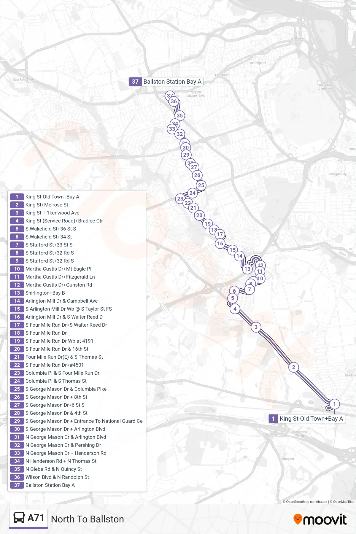
Stops list (A71 - North To Ballston)
- King St-Old Town+Bay A
- King St+Melrose St
- King St + 1kenwood Ave
- King St (Service Road)+Bradlee Ctr
- S Wakefield St+36 St S
- S Wakefield St+34 St
- S Stafford St+33 St S
- S Stafford St+32 Rd S
- S Stafford St+32 Rd S
- Martha Custis Dr+Mt Eagle Pl
- Martha Custis Dr+Fitzgerald Ln
- Martha Custis Dr+Gunston Rd
- Shirlington+Bay B
- Arlington Mill Dr & Campbell Ave
- S Arlington Mill Dr Wb @ S Taylor St FS
- Arlington Mill Dr & S Walter Reed D
- S Four Mile Run Dr+S Walter Reed Dr
- S Four Mile Run Dr
- S Four Mile Run Dr Wb at 4191
- S Four Mile Run Dr & 16th St
- Four Mile Run Dr(E) & S Thomas St
- S Four Mile Run Dr+#4501
- Columbia Pi & S Four Mile Run Dr
- Columbia Pi & S Thomas St
- S George Mason Dr & Columbia Pike
- S George Mason Dr + 8th St
- S George Mason Dr+6 St S
- S George Mason Dr & 4th St
- S George Mason Dr + Entrance To National Guard Ce
- S George Mason Dr + Arlington Blvd
- N George Mason Dr & Arlington Blvd
- N George Mason Dr & Pershing Dr
- N George Mason Dr + Henderson Rd
- N Henderson Rd + N Thomas St
- N Glebe Rd & N Quincy St
- Wilson Blvd & N Randolph St
- Ballston Station Bay A