
A-53-R Bus Route Map
View the A-53-R route map and see all A-53-R stops along the route. The map of A-53-R shows where the bus travels and the location of each stop, making it easy to understand the entire route at a glance.
Explore Alimentadora routes on the map and see where Alimentadora bus services operate. Use the A-53-R map to find bus stops and see how the A-53-R connects different areas along its trip.
All A-53-R stops on the map are displayed in route order, helping you follow the A-53-R bus from the first stop to the last.
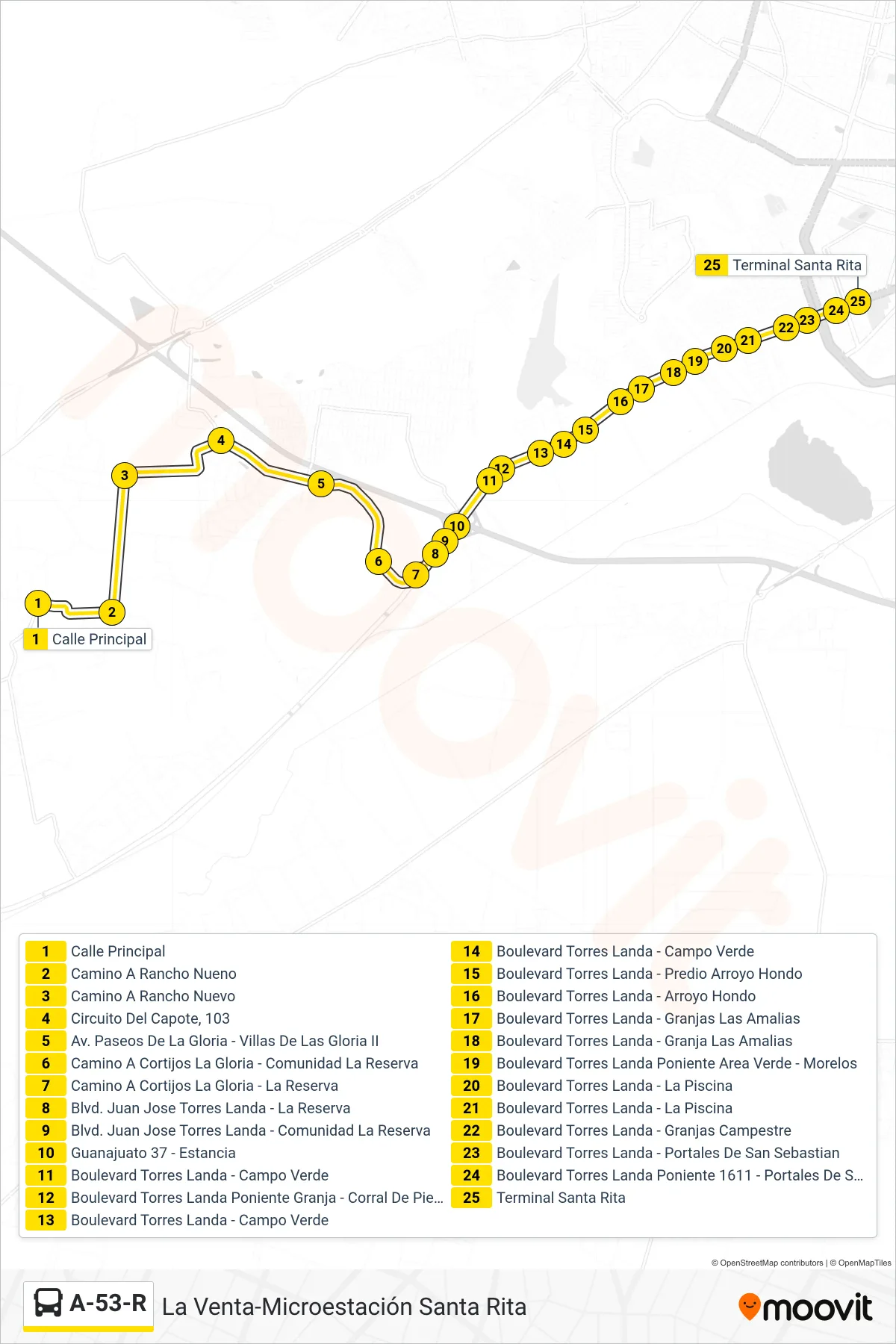
Stops list (A-53-R - La Venta-Microestación Santa Rita)
- Calle Principal
- Camino A Rancho Nueno
- Camino A Rancho Nuevo
- Circuito Del Capote, 103
- Av. Paseos De La Gloria - Villas De Las Gloria II
- Camino A Cortijos La Gloria - Comunidad La Reserva
- Camino A Cortijos La Gloria - La Reserva
- Blvd. Juan Jose Torres Landa - La Reserva
- Blvd. Juan Jose Torres Landa - Comunidad La Reserva
- Guanajuato 37 - Estancia
- Boulevard Torres Landa - Campo Verde
- Boulevard Torres Landa Poniente Granja - Corral De Piedra
- Boulevard Torres Landa - Campo Verde
- Boulevard Torres Landa - Campo Verde
- Boulevard Torres Landa - Predio Arroyo Hondo
- Boulevard Torres Landa - Arroyo Hondo
- Boulevard Torres Landa - Granjas Las Amalias
- Boulevard Torres Landa - Granja Las Amalias
- Boulevard Torres Landa Poniente Area Verde - Morelos
- Boulevard Torres Landa - La Piscina
- Boulevard Torres Landa - La Piscina
- Boulevard Torres Landa - Granjas Campestre
- Boulevard Torres Landa - Portales De San Sebastian
- Boulevard Torres Landa Poniente 1611 - Portales De San Sebastián
- Terminal Santa Rita