
AGRO Tram Route Map
View the AGRO route map and see all AGRO stops along the route. The map of AGRO shows where the tram travels and the location of each stop, making it easy to understand the entire route at a glance.
Explore routes on the map and see where tram services operate. Use the AGRO map to find tram stations and see how the AGRO connects different areas along its trip.
All AGRO stops on the map are displayed in route order, helping you follow the AGRO tram from the first station to the last.
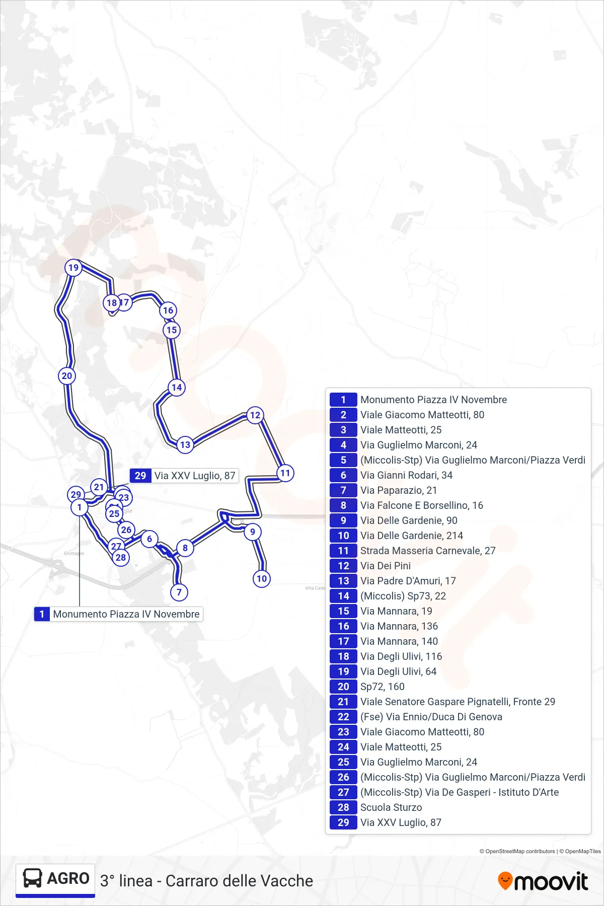
Stops list (AGRO - Monument Piazza IV November→July 25th Street, 87)
- Monument Piazza IV November
- Giacomo Matteotti Avenue, 80
- Matteotti Avenue, 25
- Guglielmo Marconi Street, 24
- (Miccolis-STP) Guglielmo Marconi Street/Verdi Square
- Gianni Rodari Street, 34
- Paparazio Street, 21
- Falcone and Borsellino Street, 16
- Via Delle Gardenie, 90
- Via Delle Gardenie, 214
- Masseria Carnevale Street, 27
- Dei Pini Street
- Father D'Amuri Street, 17
- (Miccolis) SP73, 22
- Via Mannara, 19
- Mannara Street, 136
- Via Mannara, 140
- Via Degli Ulivi, 116
- Olive Trees Street, 64
- Sp72, 160
- Viale Senator Gaspare Pignatelli, Opposite 29
- (FSE) Ennio Street/Duke of Genoa
- Giacomo Matteotti Avenue, 80
- Matteotti Avenue, 25
- Guglielmo Marconi Street, 24
- (Miccolis-STP) Guglielmo Marconi Street/Verdi Square
- (Miccolis-Stp) De Gasperi Street - Art Institute
- Sturzo School
- July 25th Street, 87