
ANTA - POSTO RADAR Bus Route Map
View the ANTA - POSTO RADAR route map and see all ANTA - POSTO RADAR stops along the route. The map of ANTA - POSTO RADAR shows where the bus travels and the location of each stop, making it easy to understand the entire route at a glance.
Explore Viação Progresso e Turismo (Sapucaia) routes on the map and see where Viação Progresso e Turismo (Sapucaia) bus services operate. Use the ANTA - POSTO RADAR map to find bus stops and see how the ANTA - POSTO RADAR connects different areas along its trip.
All ANTA - POSTO RADAR stops on the map are displayed in route order, helping you follow the ANTA - POSTO RADAR bus from the first stop to the last.
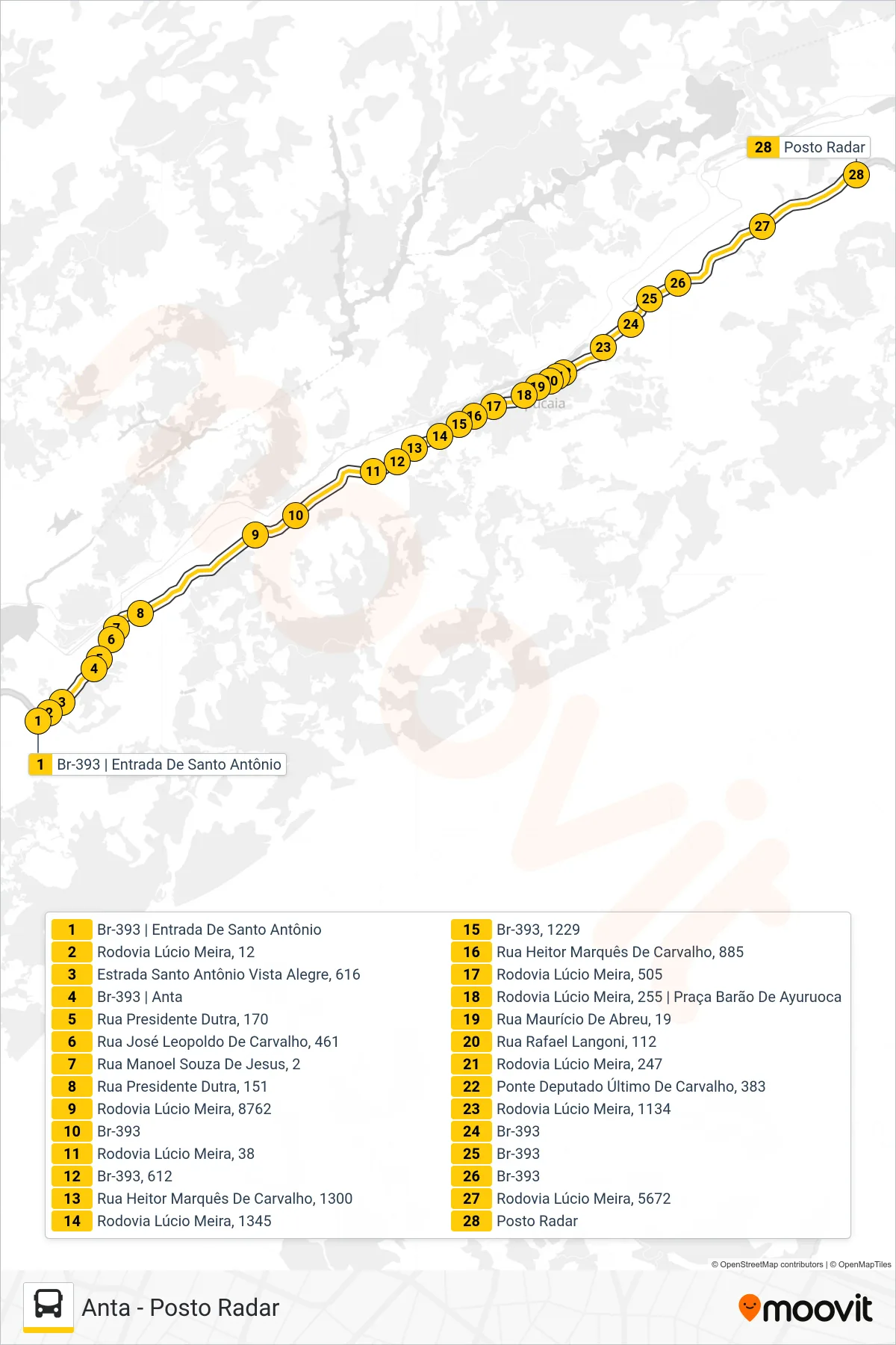
Stops list (ANTA - POSTO RADAR - Posto Radar)
- Br-393 | Entrada De Santo Antônio
- Rodovia Lúcio Meira, 12
- Estrada Santo Antônio Vista Alegre, 616
- Br-393 | Anta
- Rua Presidente Dutra, 170
- Rua José Leopoldo De Carvalho, 461
- Rua Manoel Souza De Jesus, 2
- Rua Presidente Dutra, 151
- Rodovia Lúcio Meira, 8762
- Br-393
- Rodovia Lúcio Meira, 38
- Br-393, 612
- Rua Heitor Marquês De Carvalho, 1300
- Rodovia Lúcio Meira, 1345
- Br-393, 1229
- Rua Heitor Marquês De Carvalho, 885
- Rodovia Lúcio Meira, 505
- Rodovia Lúcio Meira, 255 | Praça Barão De Ayuruoca
- Rua Maurício De Abreu, 19
- Rua Rafael Langoni, 112
- Rodovia Lúcio Meira, 247
- Ponte Deputado Último De Carvalho, 383
- Rodovia Lúcio Meira, 1134
- Br-393
- Br-393
- Br-393
- Rodovia Lúcio Meira, 5672
- Posto Radar