
AT Tram Route Map
View the AT route map and see all AT stops along the route. The map of AT shows where the tram travels and the location of each stop, making it easy to understand the entire route at a glance.
Explore routes on the map and see where tram services operate. Use the AT map to find tram stations and see how the AT connects different areas along its trip.
All AT stops on the map are displayed in route order, helping you follow the AT tram from the first station to the last.
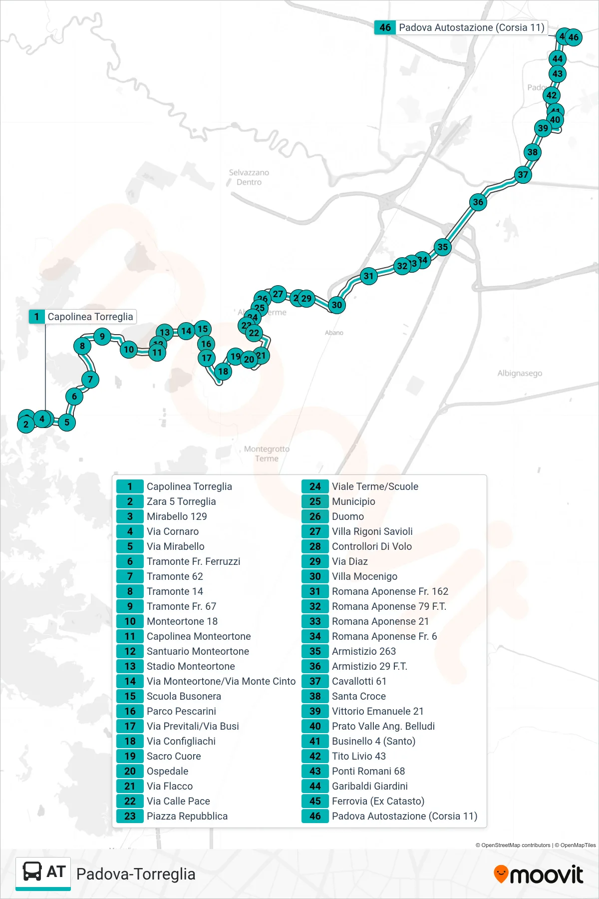
Stops list (AT - Torreglia Terminal to Padova Bus Station)
- Torreglia Terminal
- Zara 5 Torreglia
- Mirabello 129
- Cornaro Street
- Mirabello Street
- Tramonte Near Ferruzzi
- Tramonte 62
- Tramonte 14
- Tramonte No. 67
- Monteortone 18
- Monteortone Terminal
- Monteortone Sanctuary
- Monteortone Stadium
- Via Monteortone/Via Monte Cinto
- Busonera School
- Pescarini Park
- Via Previtali/Via Busi
- Configliachi Street
- Sacred Heart
- Hospital
- Flacco Street
- Via Calle Pace
- Republic Square
- Terme Avenue/Schools
- City Hall
- Duomo
- Villa Rigoni Savioli
- Flight Controllers
- Diaz Street
- Villa Mocenigo
- Romana Aponense Opposite 162
- 79 Romana Aponense F.T.
- Romana Aponense 21
- Romana Aponense No. 6
- Armistizio 263
- Armistice 29
- Cavallotti 61
- Santa Croce
- Vittorio Emanuele 21
- Prato Valle Corner Belludi
- Businello 4 (Santo)
- Tito Livio 43
- Roman Bridges 68
- Garibaldi Gardens
- Railway (Former Land Registry)
- Padua Bus Station (Platform 11)