
AZNT Bus Route Map
View the AZNT route map and see all AZNT stops along the route. The map of AZNT shows where the bus travels and the location of each stop, making it easy to understand the entire route at a glance.
Explore ASTRAL routes on the map and see where ASTRAL bus services operate. Use the AZNT map to find bus stops and see how the AZNT connects different areas along its trip.
All AZNT stops on the map are displayed in route order, helping you follow the AZNT bus from the first stop to the last.
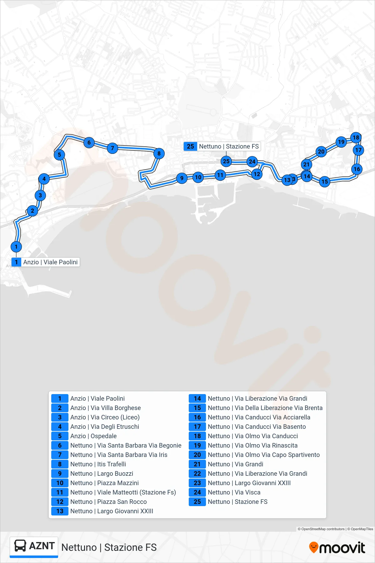
Stops list (AZNT - Nettuno | Railway Station)
- Anzio via Viale Paolini
- Anzio | Villa Borghese Street
- Anzio | Circeo Street (High School)
- Anzio | Etruscan Street
- Anzio | Hospital
- Nettuno | Santa Barbara Street Begonie Street
- Nettuno | Via Santa Barbara Via Iris
- Nettuno | Trafelli Technical Institute
- Nettuno | Buozzi Square
- Nettuno | Mazzini Square
- Nettuno | Matteotti Avenue (Railway Station)
- Nettuno | San Rocco Square
- Nettuno | John XXIII Square
- Nettuno - Via Liberazione Via Grandi
- Nettuno via Della Liberazione via Brenta
- Nettuno | Canducci Road Acciarella Road
- Nettuno | Canducci Street Basento Street
- Nettuno | Olmo Street Canducci Street
- Nettuno | Elm Street Renaissance Street
- Nettuno | Via Olmo Via Capo Spartivento
- Nettuno | Grandi Street
- Nettuno - Via Liberazione Via Grandi
- Nettuno | John XXIII Square
- Nettuno | Visca Street
- Nettuno | Railway Station