
B Bus Route Map
View the B route map and see all B stops along the route. The map of B shows where the bus travels and the location of each stop, making it easy to understand the entire route at a glance.
Explore ATMA S.c.p.a. routes on the map and see where ATMA S.c.p.a. bus services operate. Use the B map to find bus stops and see how the B connects different areas along its trip.
All B stops on the map are displayed in route order, helping you follow the B bus from the first stop to the last.
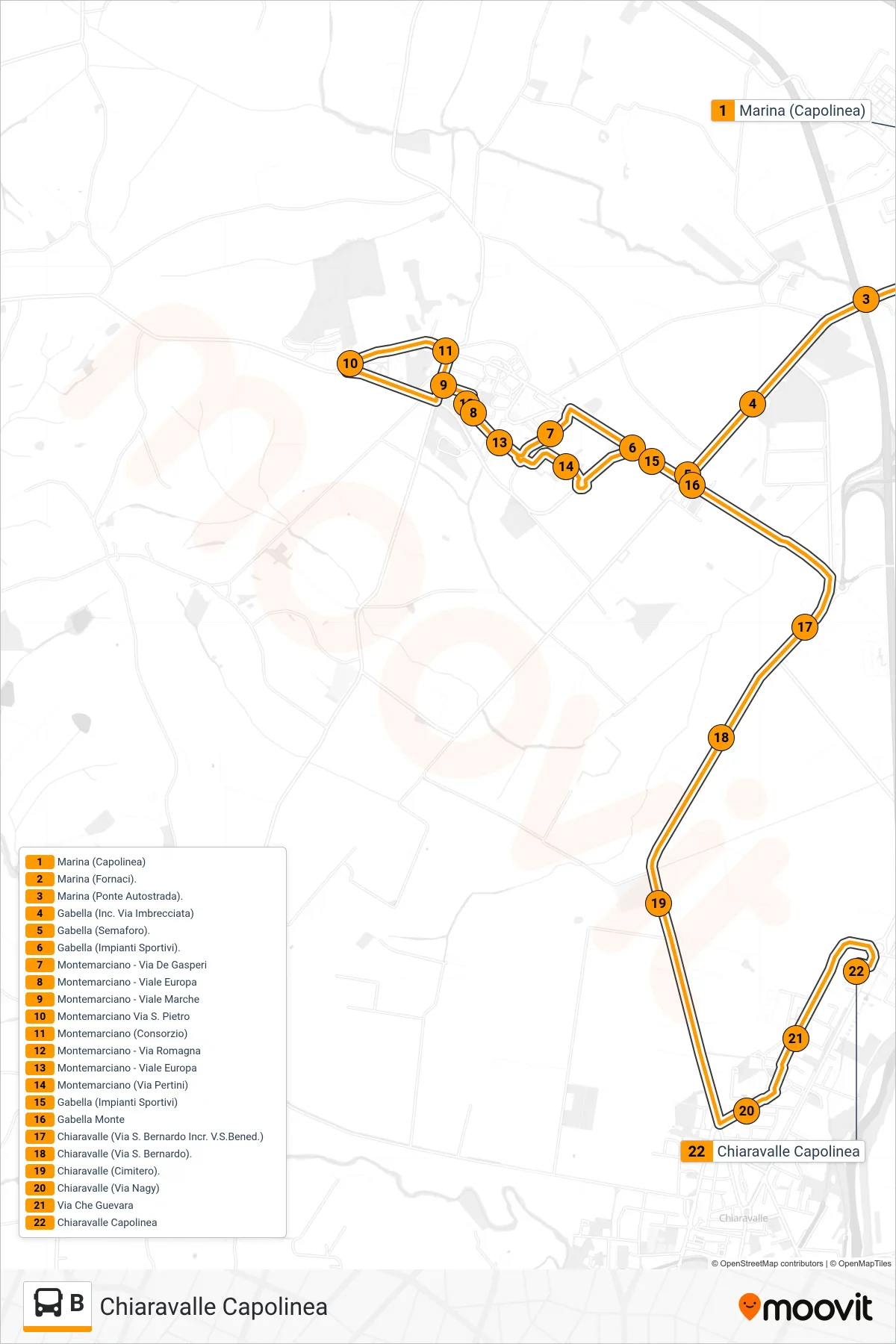
Stops list (B - Chiaravalle Terminal)
- Marina (Terminal)
- Marina (Fornaci)
- Marina (Highway Bridge)
- Gabella (Via Imbrecciata Junction)
- Gabella (Traffic Light)
- Gabella (Sports Facilities)
- Montemarciano - De Gasperi Street
- Montemarciano - Europa Avenue
- Montemarciano - Marche Avenue
- Montemarciano Via San Pietro
- Montemarciano (Consortium)
- Montemarciano - Via Romagna
- Montemarciano - Europa Avenue
- Montemarciano (Pertini Street)
- Gabella (Sports Facilities)
- Upper Gabella
- Chiaravalle (San Bernardo St. intersection with San Benedetto)
- Chiaravalle (San Bernardo Street)
- Chiaravalle (Cemetery)
- Chiaravalle (Nagy Street)
- Che Guevara Street
- Chiaravalle Terminal
Change direction
- Route Map - B - Falconara Train Station
- Route Map - B - Montemarciano (Ring Road)
- Route Map - B - Montemarciano Via San Pietro
- Route Map - B - Marina (Banca Marche)
- Route Map - B - Falconara - Via Bottego
- Route Map - B - Marina Skating
- Route Map - B - Ancona (Gervasoni Institute)
- Route Map - B - Falconara (Cambi High School)
- Route Map - B - Falconara Train Station
- Route Map - B - Torrette - Itis
- Route Map - B - Marina (Terminal)
- Route Map - B - Marina (Terminal)
- Route Map - B - Piazza Cavour (Conerobus North Lines)
- Route Map - B - Ancona Via Togliatti (Monte Dago Schools)