
B Subway Route Map
View the B route map and see all B stops along the route. The map of B shows where the subway travels and the location of each stop, making it easy to understand the entire route at a glance.
Explore RET routes on the map and see where RET subway services operate. Use the B map to find subway stations and see how the B connects different areas along its trip.
All B stops on the map are displayed in route order, helping you follow the B subway from the first station to the last.
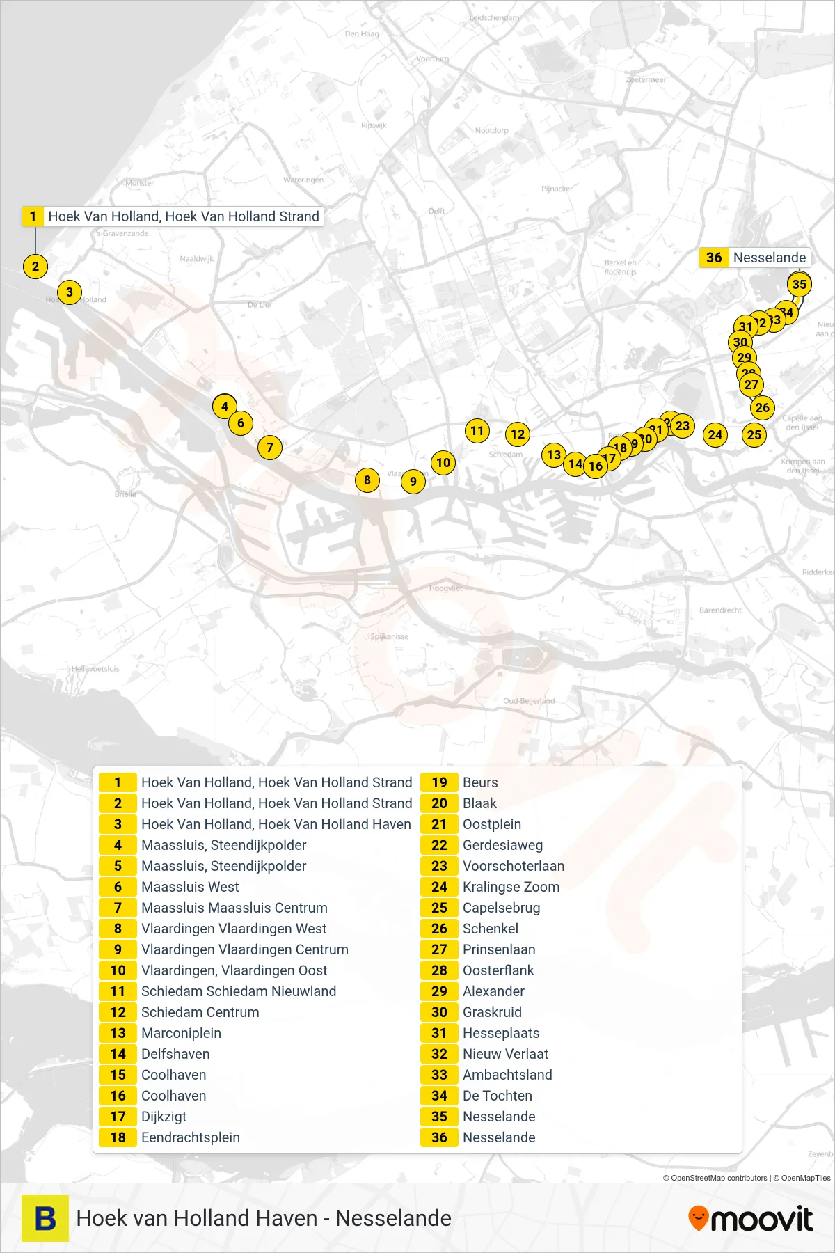
Stops list (B - Nesselande)
- Hoek Van Holland, Hoek Van Holland Strand
- Hoek Van Holland, Hoek Van Holland Strand
- Hoek Van Holland, Hoek Van Holland Haven
- Maassluis, Steendijkpolder
- Maassluis, Steendijkpolder
- Maassluis West
- Maassluis Maassluis Centrum
- Vlaardingen Vlaardingen West
- Vlaardingen Vlaardingen Centrum
- Vlaardingen, Vlaardingen Oost
- Schiedam Schiedam Nieuwland
- Schiedam Centrum
- Marconiplein
- Delfshaven
- Coolhaven
- Dijkzigt
- Eendrachtsplein
- Beurs
- Blaak
- Oostplein
- Gerdesiaweg
- Voorschoterlaan
- Kralingse Zoom
- Capelsebrug
- Schenkel
- Prinsenlaan
- Oosterflank
- Alexander
- Graskruid
- Hesseplaats
- Nieuw Verlaat
- Ambachtsland
- De Tochten
- Nesselande
- Nesselande