
B Bus Route Map
View the B route map and see all B stops along the route. The map of B shows where the bus travels and the location of each stop, making it easy to understand the entire route at a glance.
Explore Chapel Hill Transit routes on the map and see where Chapel Hill Transit bus services operate. Use the B map to find bus stops and see how the B connects different areas along its trip.
All B stops on the map are displayed in route order, helping you follow the B bus from the first stop to the last.
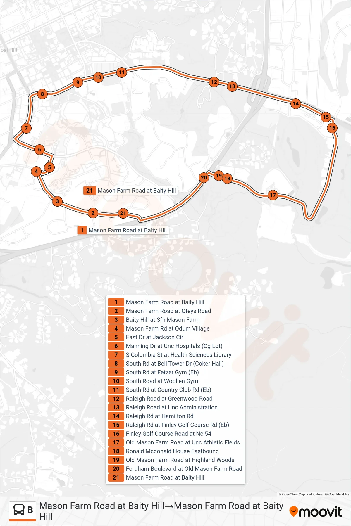
Stops list (B - Mason Farm Road at Baity Hill→Mason Farm Road at Baity Hill)
- Mason Farm Road at Baity Hill
- Mason Farm Road at Oteys Road
- Baity Hill at Sfh Mason Farm
- Mason Farm Rd at Odum Village
- East Dr at Jackson Cir
- Manning Dr at Unc Hospitals (Cg Lot)
- S Columbia St at Health Sciences Library
- South Rd at Bell Tower Dr (Coker Hall)
- South Rd at Fetzer Gym (Eb)
- South Road at Woollen Gym
- South Rd at Country Club Rd (Eb)
- Raleigh Road at Greenwood Road
- Raleigh Road at Unc Administration
- Raleigh Rd at Hamilton Rd
- Raleigh Rd at Finley Golf Course Rd (Eb)
- Finley Golf Course Road at Nc 54
- Old Mason Farm Road at Unc Athletic Fields
- Ronald Mcdonald House Eastbound
- Old Mason Farm Road at Highland Woods
- Fordham Boulevard at Old Mason Farm Road
- Mason Farm Road at Baity Hill