
B43 Bus Route Map
View the B43 route map and see all B43 stops along the route. The map of B43 shows where the bus travels and the location of each stop, making it easy to understand the entire route at a glance.
Explore Pioneer Valley Transit Authority routes on the map and see where Pioneer Valley Transit Authority bus services operate. Use the B43 map to find bus stops and see how the B43 connects different areas along its trip.
All B43 stops on the map are displayed in route order, helping you follow the B43 bus from the first stop to the last.
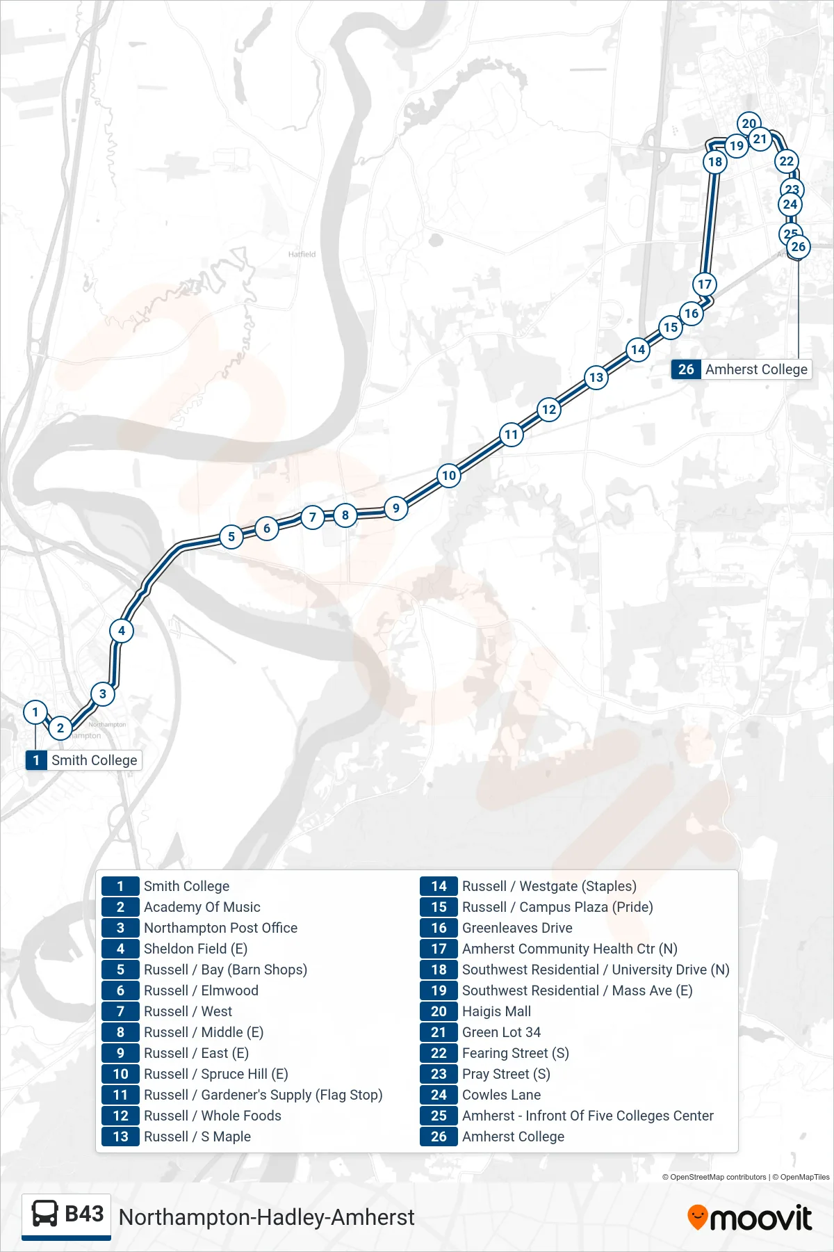
Stops list (B43 - Amherst College)
- Smith College
- Academy Of Music
- Northampton Post Office
- Sheldon Field (E)
- Russell / Bay (Barn Shops)
- Russell / Elmwood
- Russell / West
- Russell / Middle (E)
- Russell / East (E)
- Russell / Spruce Hill (E)
- Russell / Gardener's Supply (Flag Stop)
- Russell / Whole Foods
- Russell / S Maple
- Russell / Westgate (Staples)
- Russell / Campus Plaza (Pride)
- Greenleaves Drive
- Amherst Community Health Ctr (N)
- Southwest Residential / University Drive (N)
- Southwest Residential / Mass Ave (E)
- Haigis Mall
- Green Lot 34
- Fearing Street (S)
- Pray Street (S)
- Cowles Lane
- Amherst - Infront Of Five Colleges Center
- Amherst College