
B44 Bus Route Map
View the B44 route map and see all B44 stops along the route. The map of B44 shows where the bus travels and the location of each stop, making it easy to understand the entire route at a glance.
Explore MTA Bus routes on the map and see where MTA Bus bus services operate. Use the B44 map to find bus stops and see how the B44 connects different areas along its trip.
All B44 stops on the map are displayed in route order, helping you follow the B44 bus from the first stop to the last.
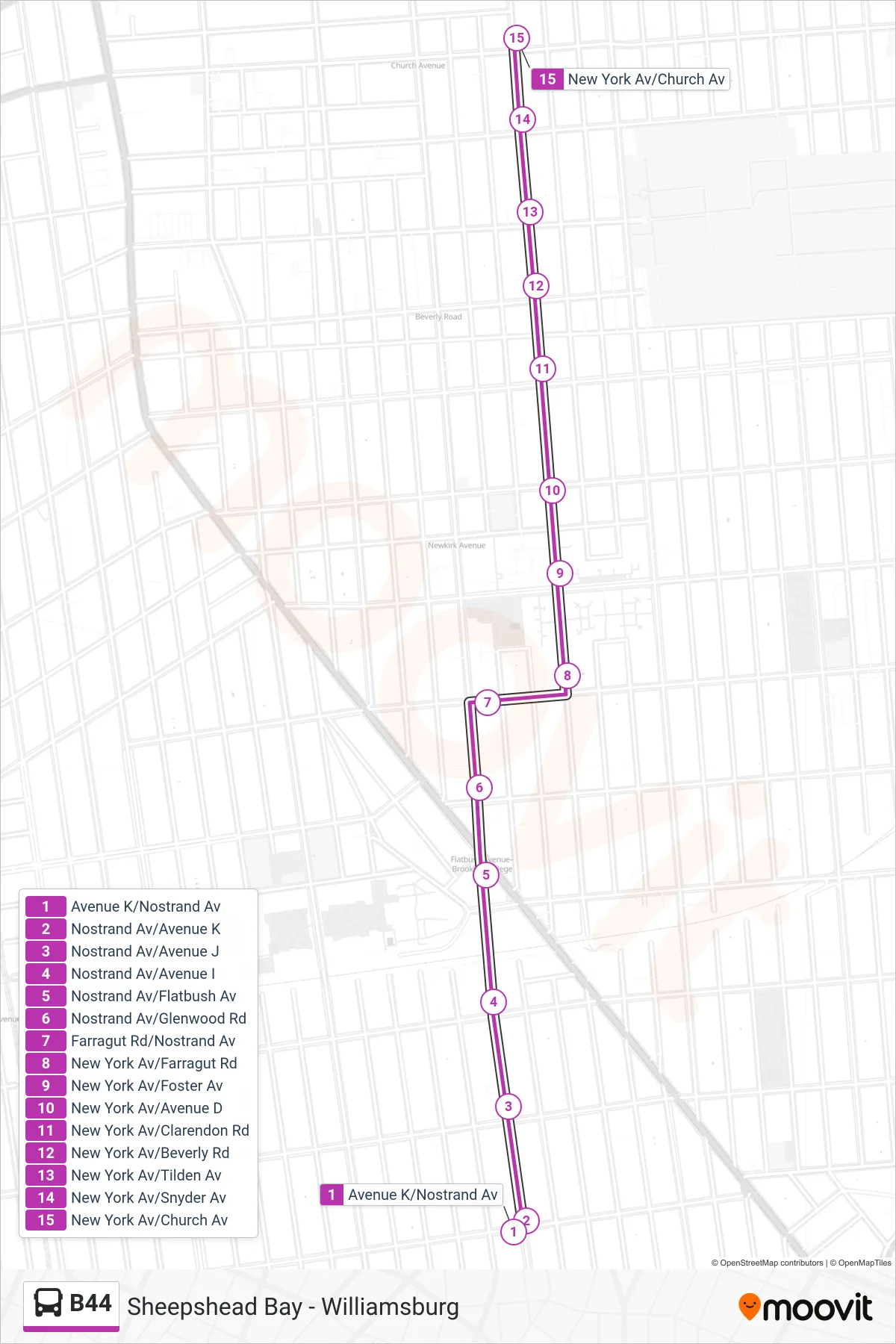
Stops list (B44 - Church Av)
- Avenue K/Nostrand Av
- Nostrand Av/Avenue K
- Nostrand Av/Avenue J
- Nostrand Av/Avenue I
- Nostrand Av/Flatbush Av
- Nostrand Av/Glenwood Rd
- Farragut Rd/Nostrand Av
- New York Av/Farragut Rd
- New York Av/Foster Av
- New York Av/Avenue D
- New York Av/Clarendon Rd
- New York Av/Beverly Rd
- New York Av/Tilden Av
- New York Av/Snyder Av
- New York Av/Church Av
Change direction
- Route Map - B44 - Flatbush Av
- Route Map - B44 - Williamsburg Bridge Plaza Via Nostrand
- Route Map - B44 - Sheepshead Bay Knapp St Via Nostrand
- Route Map - B44 - Avenue U Via Nostrand
- Route Map - B44 - Flushing Av Via Nostrand
- Route Map - B44 - Emmons Av
- Route Map - B44 - Avenue X
- Route Map - B44 - Fulton St