
BAM Bus Route Map
View the BAM route map and see all BAM stops along the route. The map of BAM shows where the bus travels and the location of each stop, making it easy to understand the entire route at a glance.
Explore Niederrheinische VKB routes on the map and see where Niederrheinische VKB bus services operate. Use the BAM map to find bus stops and see how the BAM connects different areas along its trip.
All BAM stops on the map are displayed in route order, helping you follow the BAM bus from the first stop to the last.
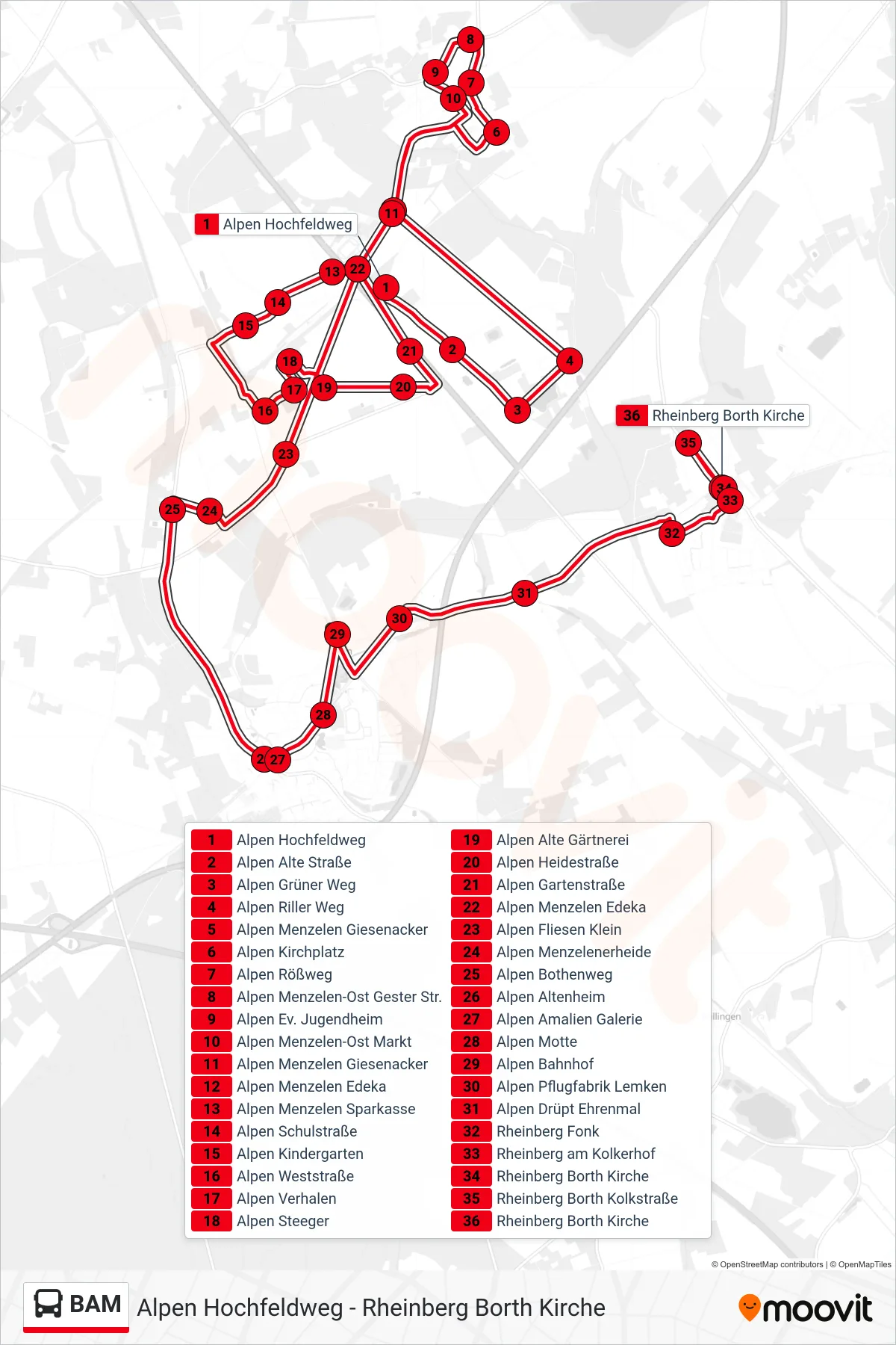
Stops list (BAM - Rheinberg Borth Kirche)
- Alpen Hochfeldweg
- Alpen Alte Straße
- Alpen Grüner Weg
- Alpen Riller Weg
- Alpen Menzelen Giesenacker
- Alpen Kirchplatz
- Alpen Rößweg
- Alpen Menzelen-Ost Gester Str.
- Alpen Ev. Jugendheim
- Alpen Menzelen-Ost Markt
- Alpen Menzelen Giesenacker
- Alpen Menzelen Edeka
- Alpen Menzelen Sparkasse
- Alpen Schulstraße
- Alpen Kindergarten
- Alpen Weststraße
- Alpen Verhalen
- Alpen Steeger
- Alpen Alte Gärtnerei
- Alpen Heidestraße
- Alpen Gartenstraße
- Alpen Menzelen Edeka
- Alpen Fliesen Klein
- Alpen Menzelenerheide
- Alpen Bothenweg
- Alpen Altenheim
- Alpen Amalien Galerie
- Alpen Motte
- Alpen Bahnhof
- Alpen Pflugfabrik Lemken
- Alpen Drüpt Ehrenmal
- Rheinberg Fonk
- Rheinberg am Kolkerhof
- Rheinberg Borth Kirche
- Rheinberg Borth Kolkstraße
- Rheinberg Borth Kirche