
BASARBOVO Bus Route Map
View the BASARBOVO route map and see all BASARBOVO stops along the route. The map of BASARBOVO shows where the bus travels and the location of each stop, making it easy to understand the entire route at a glance.
Explore Geocommerce Ltd routes on the map and see where Geocommerce Ltd bus services operate. Use the BASARBOVO map to find bus stops and see how the BASARBOVO connects different areas along its trip.
All BASARBOVO stops on the map are displayed in route order, helping you follow the BASARBOVO bus from the first stop to the last.
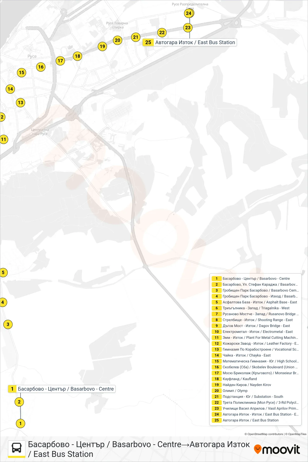
Stops list (BASARBOVO - East Bus Station)
- Basarbovo - Center
- Basarbovo, Stefan Karadzha Street
- Basarbovo Cemetery
- Basarbovo Cemetery - Exit
- Asphalt Base - East
- Triagalnika - West
- Rusanovo Bridge - West
- Shooting Range - East
- Dagov Bridge - East
- Electrometal - East
- Plant For Metal Cutting Machines - East
- Leather Factory - East
- Vocational School Of River Shipbuilding And Navigation
- Chayka - East
- High School of Mathematics - South
- Skobelev Boulevard (Union Of Bulgarian Motorists)
- Monsieur Bricolage (The Roundabout)
- Kaufland
- Nayden Kirov
- Olymp
- Substation - South
- 3rd Polyclinic (Mall Of Ruse)
- Vasil Aprilov School
- East Bus Station - East
- East Bus Station