
BBO Bus Route Map
View the BBO route map and see all BBO stops along the route. The map of BBO shows where the bus travels and the location of each stop, making it easy to understand the entire route at a glance.
Explore BB Bürgerbus routes on the map and see where BB Bürgerbus bus services operate. Use the BBO map to find bus stops and see how the BBO connects different areas along its trip.
All BBO stops on the map are displayed in route order, helping you follow the BBO bus from the first stop to the last.
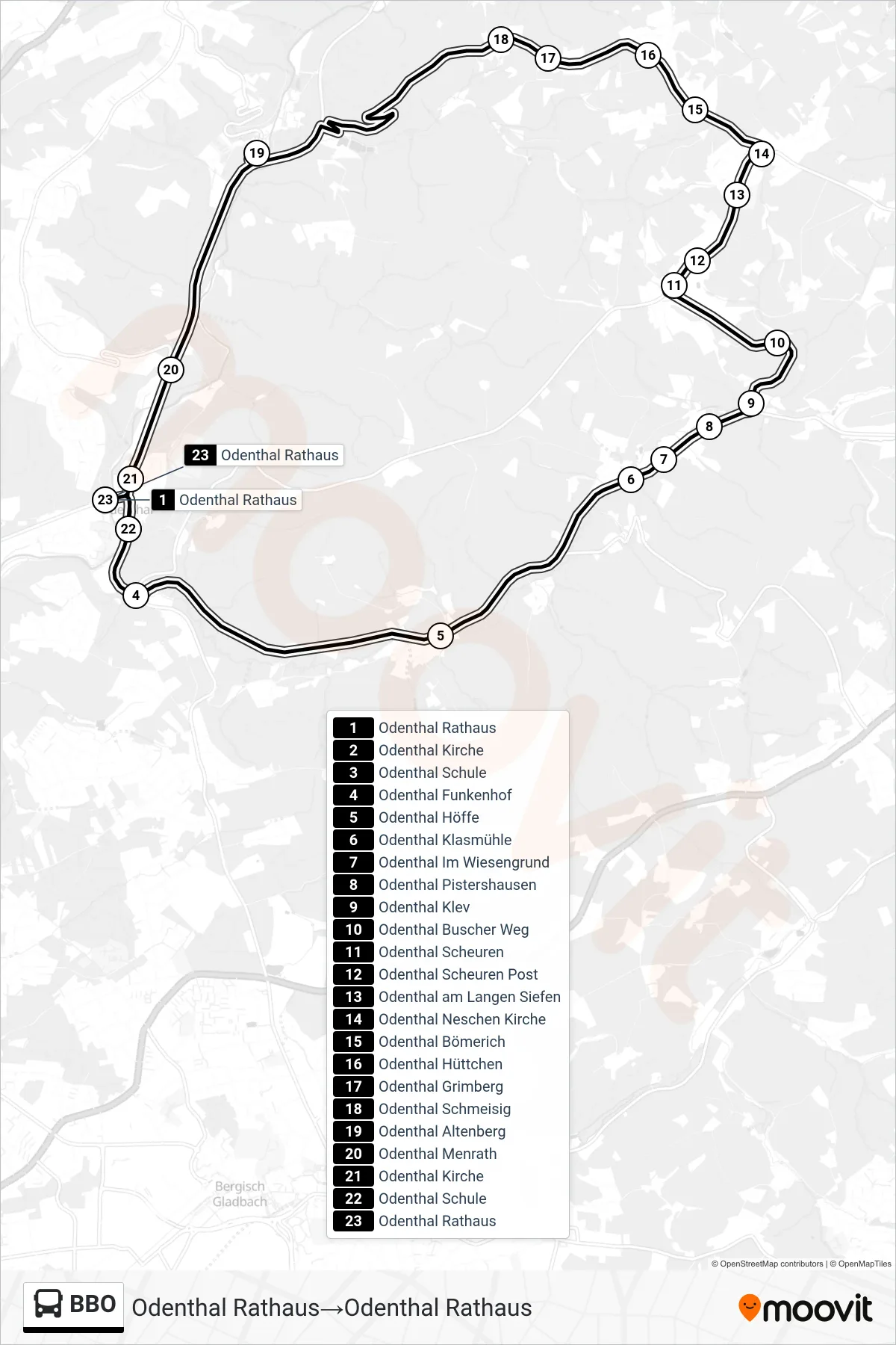
Stops list (BBO - Odenthal Rathaus→Odenthal Rathaus)
- Odenthal Rathaus
- Odenthal Kirche
- Odenthal Schule
- Odenthal Funkenhof
- Odenthal Höffe
- Odenthal Klasmühle
- Odenthal Im Wiesengrund
- Odenthal Pistershausen
- Odenthal Klev
- Odenthal Buscher Weg
- Odenthal Scheuren
- Odenthal Scheuren Post
- Odenthal am Langen Siefen
- Odenthal Neschen Kirche
- Odenthal Bömerich
- Odenthal Hüttchen
- Odenthal Grimberg
- Odenthal Schmeisig
- Odenthal Altenberg
- Odenthal Menrath
- Odenthal Kirche
- Odenthal Schule
- Odenthal Rathaus
Change direction
- Route Map - BBO - Odenthal Rathaus→Odenthal Schmeisig
- Route Map - BBO - Odenthal Pistershausen→Odenthal Rathaus
- Route Map - BBO - Odenthal Hüttchen→Odenthal Rathaus
- Route Map - BBO - Odenthal Rathaus→Odenthal Rathaus
- Route Map - BBO - Odenthal Schmeisig→Odenthal Rathaus
- Route Map - BBO - Odenthal Rathaus→Odenthal Pistershausen