
BETHANYLINK Bus Route Map
View the BETHANYLINK route map and see all BETHANYLINK stops along the route. The map of BETHANYLINK shows where the bus travels and the location of each stop, making it easy to understand the entire route at a glance.
Explore Ride Connection routes on the map and see where Ride Connection bus services operate. Use the BETHANYLINK map to find bus stops and see how the BETHANYLINK connects different areas along its trip.
All BETHANYLINK stops on the map are displayed in route order, helping you follow the BETHANYLINK bus from the first stop to the last.
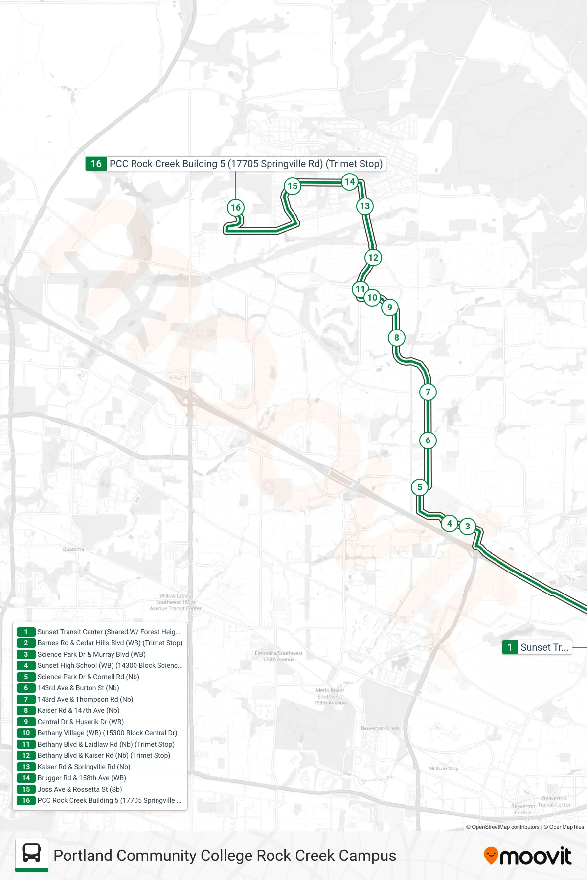
Stops list (BETHANYLINK - Portland Community College Rock Creek Campus)
- Sunset Transit Center (Shared W/ Forest Heights Shuttle)
- Barnes Rd & Cedar Hills Blvd (WB) (Trimet Stop)
- Science Park Dr & Murray Blvd (WB)
- Sunset High School (WB) (14300 Block Science Park Dr)
- Science Park Dr & Cornell Rd (Nb)
- 143rd Ave & Burton St (Nb)
- 143rd Ave & Thompson Rd (Nb)
- Kaiser Rd & 147th Ave (Nb)
- Central Dr & Huserik Dr (WB)
- Bethany Village (WB) (15300 Block Central Dr)
- Bethany Blvd & Laidlaw Rd (Nb) (Trimet Stop)
- Bethany Blvd & Kaiser Rd (Nb) (Trimet Stop)
- Kaiser Rd & Springville Rd (Nb)
- Brugger Rd & 158th Ave (WB)
- Joss Ave & Rossetta St (Sb)
- PCC Rock Creek Building 5 (17705 Springville Rd) (Trimet Stop)