
BLACK Bus Route Map
View the BLACK route map and see all BLACK stops along the route. The map of BLACK shows where the bus travels and the location of each stop, making it easy to understand the entire route at a glance.
Explore Harrisonburg Transit routes on the map and see where Harrisonburg Transit bus services operate. Use the BLACK map to find bus stops and see how the BLACK connects different areas along its trip.
All BLACK stops on the map are displayed in route order, helping you follow the BLACK bus from the first stop to the last.
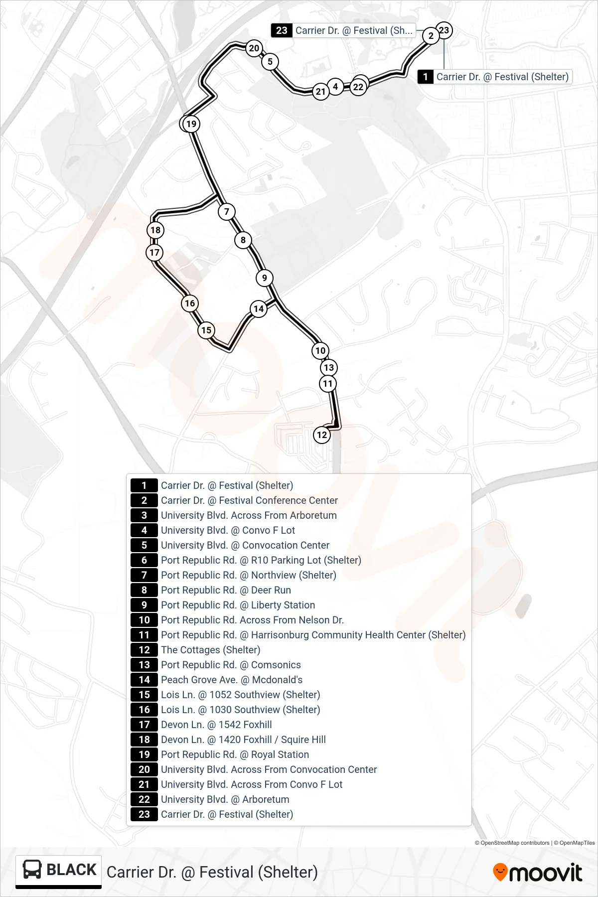
Stops list (BLACK - Carrier Dr. @ Festival (Shelter))
- Carrier Dr. @ Festival (Shelter)
- Carrier Dr. @ Festival Conference Center
- University Blvd. Across From Arboretum
- University Blvd. @ Convo F Lot
- University Blvd. @ Convocation Center
- Port Republic Rd. @ R10 Parking Lot (Shelter)
- Port Republic Rd. @ Northview (Shelter)
- Port Republic Rd. @ Deer Run
- Port Republic Rd. @ Liberty Station
- Port Republic Rd. Across From Nelson Dr.
- Port Republic Rd. @ Harrisonburg Community Health Center (Shelter)
- The Cottages (Shelter)
- Port Republic Rd. @ Comsonics
- Peach Grove Ave. @ Mcdonald's
- Lois Ln. @ 1052 Southview (Shelter)
- Lois Ln. @ 1030 Southview (Shelter)
- Devon Ln. @ 1542 Foxhill
- Devon Ln. @ 1420 Foxhill / Squire Hill
- Port Republic Rd. @ Royal Station
- University Blvd. Across From Convocation Center
- University Blvd. Across From Convo F Lot
- University Blvd. @ Arboretum
- Carrier Dr. @ Festival (Shelter)