
BLUE Bus Route Map
View the BLUE route map and see all BLUE stops along the route. The map of BLUE shows where the bus travels and the location of each stop, making it easy to understand the entire route at a glance.
Explore Calvert County Transportation routes on the map and see where Calvert County Transportation bus services operate. Use the BLUE map to find bus stops and see how the BLUE connects different areas along its trip.
All BLUE stops on the map are displayed in route order, helping you follow the BLUE bus from the first stop to the last.
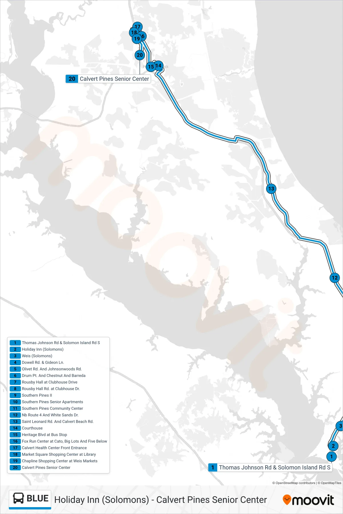
Stops list (BLUE - Prince Frederick)
- Thomas Johnson Rd & Solomon Island Rd S
- Holiday Inn (Solomons)
- Weis (Solomons)
- Dowell Rd. & Gideon Ln.
- Olivet Rd. And Johnsonwoods Rd.
- Drum Pt. And Chestnut And Barreda
- Rousby Hall at Clubhouse Drive
- Rousby Hall Rd. at Clubhouse Dr.
- Southern Pines II
- Southern Pines Senior Apartments
- Southern Pines Community Center
- Nb Route 4 And White Sands Dr.
- Saint Leonard Rd. And Calvert Beach Rd.
- Courthouse
- Heritage Blvd at Bus Stop
- Fox Run Center at Cato, Big Lots And Five Below
- Calvert Health Center Front Entrance
- Market Square Shopping Center at Library
- Chapline Shopping Center at Weis Markets
- Calvert Pines Senior Center