
BLUE Bus Route Map
View the BLUE route map and see all BLUE stops along the route. The map of BLUE shows where the bus travels and the location of each stop, making it easy to understand the entire route at a glance.
Explore STAR Transit routes on the map and see where STAR Transit bus services operate. Use the BLUE map to find bus stops and see how the BLUE connects different areas along its trip.
All BLUE stops on the map are displayed in route order, helping you follow the BLUE bus from the first stop to the last.
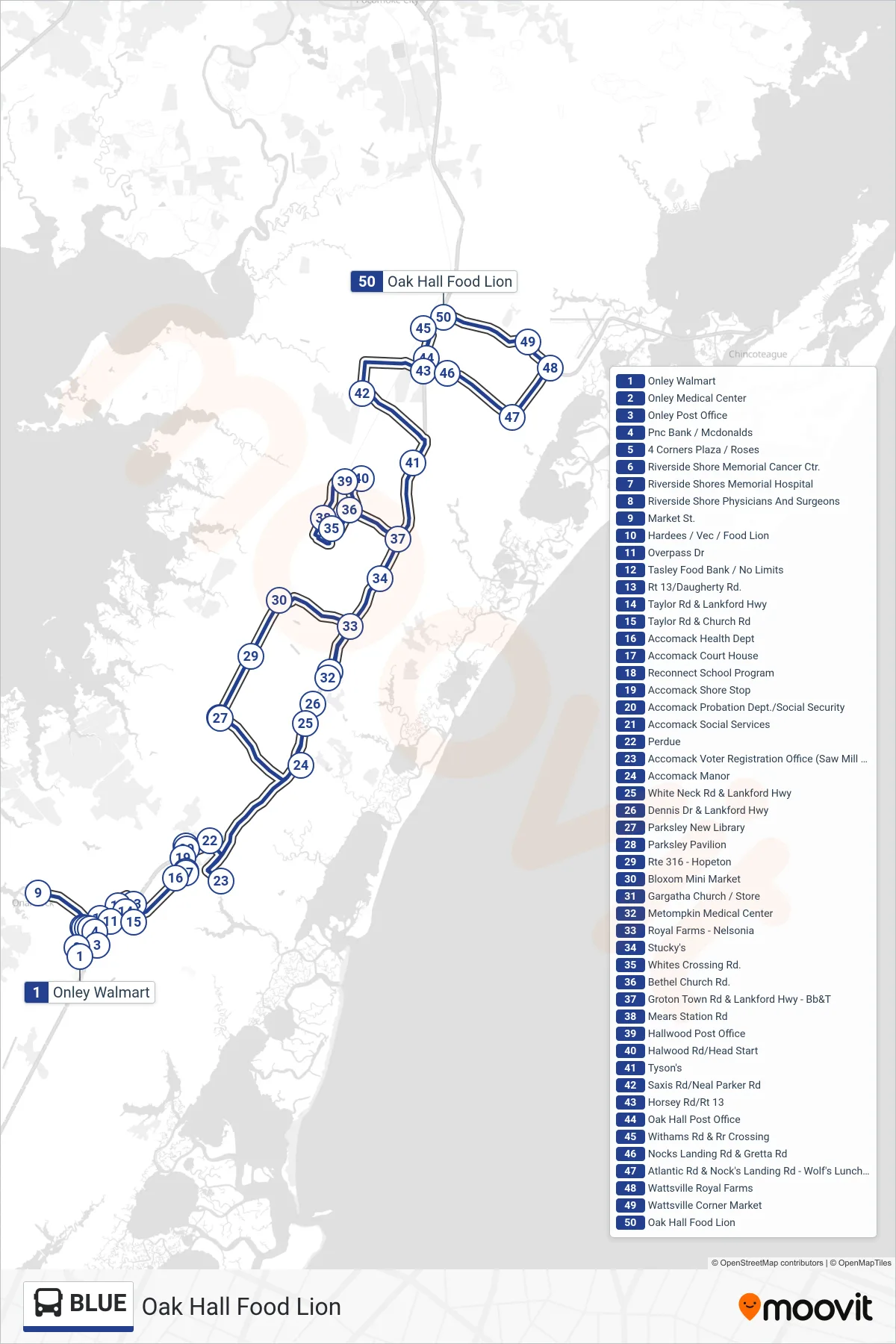
Stops list (BLUE - Oak Hall Food Lion)
- Onley Walmart
- Onley Medical Center
- Onley Post Office
- Pnc Bank / Mcdonalds
- 4 Corners Plaza / Roses
- Riverside Shore Memorial Cancer Ctr.
- Riverside Shores Memorial Hospital
- Riverside Shore Physicians And Surgeons
- Market St.
- Hardees / Vec / Food Lion
- Overpass Dr
- Tasley Food Bank / No Limits
- Rt 13/Daugherty Rd.
- Taylor Rd & Lankford Hwy
- Taylor Rd & Church Rd
- Accomack Health Dept
- Accomack Court House
- Reconnect School Program
- Accomack Shore Stop
- Accomack Probation Dept./Social Security
- Accomack Social Services
- Perdue
- Accomack Voter Registration Office (Saw Mill Park)
- Accomack Manor
- White Neck Rd & Lankford Hwy
- Dennis Dr & Lankford Hwy
- Parksley New Library
- Parksley Pavilion
- Rte 316 - Hopeton
- Bloxom Mini Market
- Gargatha Church / Store
- Metompkin Medical Center
- Royal Farms - Nelsonia
- Stucky's
- Whites Crossing Rd.
- Bethel Church Rd.
- Groton Town Rd & Lankford Hwy - Bb&T
- Mears Station Rd
- Hallwood Post Office
- Halwood Rd/Head Start
- Tyson's
- Saxis Rd/Neal Parker Rd
- Horsey Rd/Rt 13
- Oak Hall Post Office
- Withams Rd & Rr Crossing
- Nocks Landing Rd & Gretta Rd
- Atlantic Rd & Nock's Landing Rd - Wolf's Luncheon
- Wattsville Royal Farms
- Wattsville Corner Market
- Oak Hall Food Lion