
BOURNE RUN Bus Route Map
View the BOURNE RUN route map and see all BOURNE RUN stops along the route. The map of BOURNE RUN shows where the bus travels and the location of each stop, making it easy to understand the entire route at a glance.
Explore Cape Cod Regional Transit Authority routes on the map and see where Cape Cod Regional Transit Authority bus services operate. Use the BOURNE RUN map to find bus stops and see how the BOURNE RUN connects different areas along its trip.
All BOURNE RUN stops on the map are displayed in route order, helping you follow the BOURNE RUN bus from the first stop to the last.
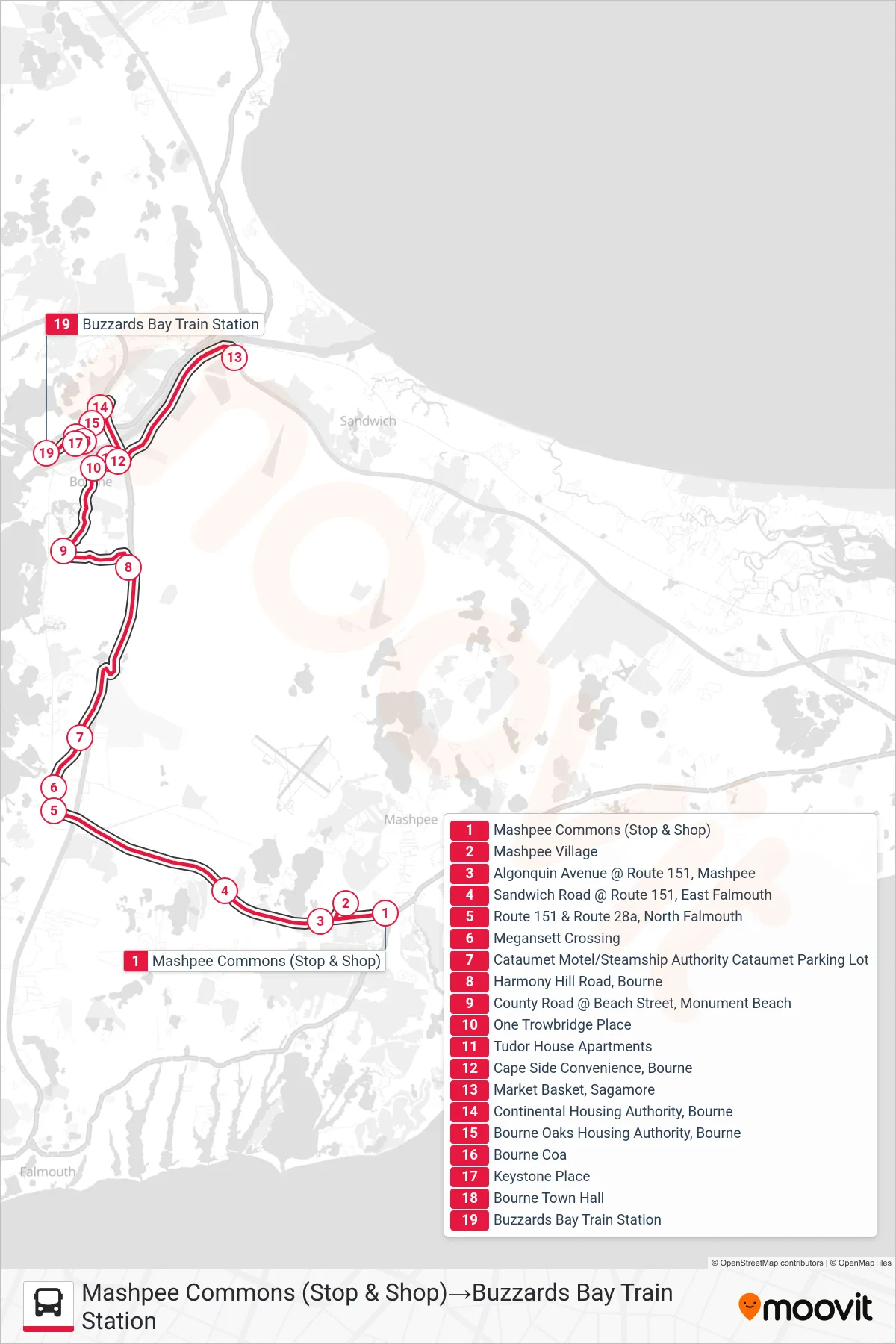
Stops list (BOURNE RUN - Mashpee Commons (Stop & Shop)→Buzzards Bay Train Station)
- Mashpee Commons (Stop & Shop)
- Mashpee Village
- Algonquin Avenue @ Route 151, Mashpee
- Sandwich Road @ Route 151, East Falmouth
- Route 151 & Route 28a, North Falmouth
- Megansett Crossing
- Cataumet Motel/Steamship Authority Cataumet Parking Lot
- Harmony Hill Road, Bourne
- County Road @ Beach Street, Monument Beach
- One Trowbridge Place
- Tudor House Apartments
- Cape Side Convenience, Bourne
- Market Basket, Sagamore
- Continental Housing Authority, Bourne
- Bourne Oaks Housing Authority, Bourne
- Bourne Coa
- Keystone Place
- Bourne Town Hall
- Buzzards Bay Train Station