
BRB Bus Route Map
View the BRB route map and see all BRB stops along the route. The map of BRB shows where the bus travels and the location of each stop, making it easy to understand the entire route at a glance.
Explore Niederrheinische VKB routes on the map and see where Niederrheinische VKB bus services operate. Use the BRB map to find bus stops and see how the BRB connects different areas along its trip.
All BRB stops on the map are displayed in route order, helping you follow the BRB bus from the first stop to the last.
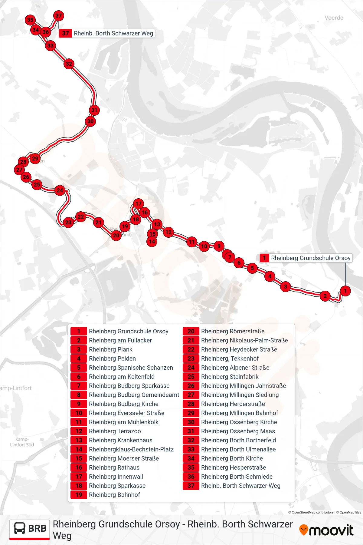
Stops list (BRB - Rheinb. Borth Schwarzer Weg)
- Rheinberg Grundschule Orsoy
- Rheinberg am Fullacker
- Rheinberg Plank
- Rheinberg Pelden
- Rheinberg Spanische Schanzen
- Rheinberg am Keltenfeld
- Rheinberg Budberg Sparkasse
- Rheinberg Budberg Gemeindeamt
- Rheinberg Budberg Kirche
- Rheinberg Eversaeler Straße
- Rheinberg am Mühlenkolk
- Rheinberg Terrazoo
- Rheinberg Krankenhaus
- Rheinbergklaus-Bechstein-Platz
- Rheinberg Moerser Straße
- Rheinberg Rathaus
- Rheinberg Innenwall
- Rheinberg Sparkasse
- Rheinberg Bahnhof
- Rheinberg Römerstraße
- Rheinberg Nikolaus-Palm-Straße
- Rheinberg Heydecker Straße
- Rheinberg, Tekkenhof
- Rheinberg Alpener Straße
- Rheinberg Steinfabrik
- Rheinberg Millingen Jahnstraße
- Rheinberg Millingen Siedlung
- Rheinberg Herderstraße
- Rheinberg Millingen Bahnhof
- Rheinberg Ossenberg Kirche
- Rheinberg Ossenberg Maas
- Rheinberg Borth Bortherfeld
- Rheinberg Borth Ulmenallee
- Rheinberg Borth Kirche
- Rheinberg Hesperstraße
- Rheinberg Borth Schmiede
- Rheinb. Borth Schwarzer Weg