
BUS Bus Route Map
View the BUS route map and see all BUS stops along the route. The map of BUS shows where the bus travels and the location of each stop, making it easy to understand the entire route at a glance.
Explore LTFRB routes on the map and see where LTFRB bus services operate. Use the BUS map to find bus stops and see how the BUS connects different areas along its trip.
All BUS stops on the map are displayed in route order, helping you follow the BUS bus from the first stop to the last.
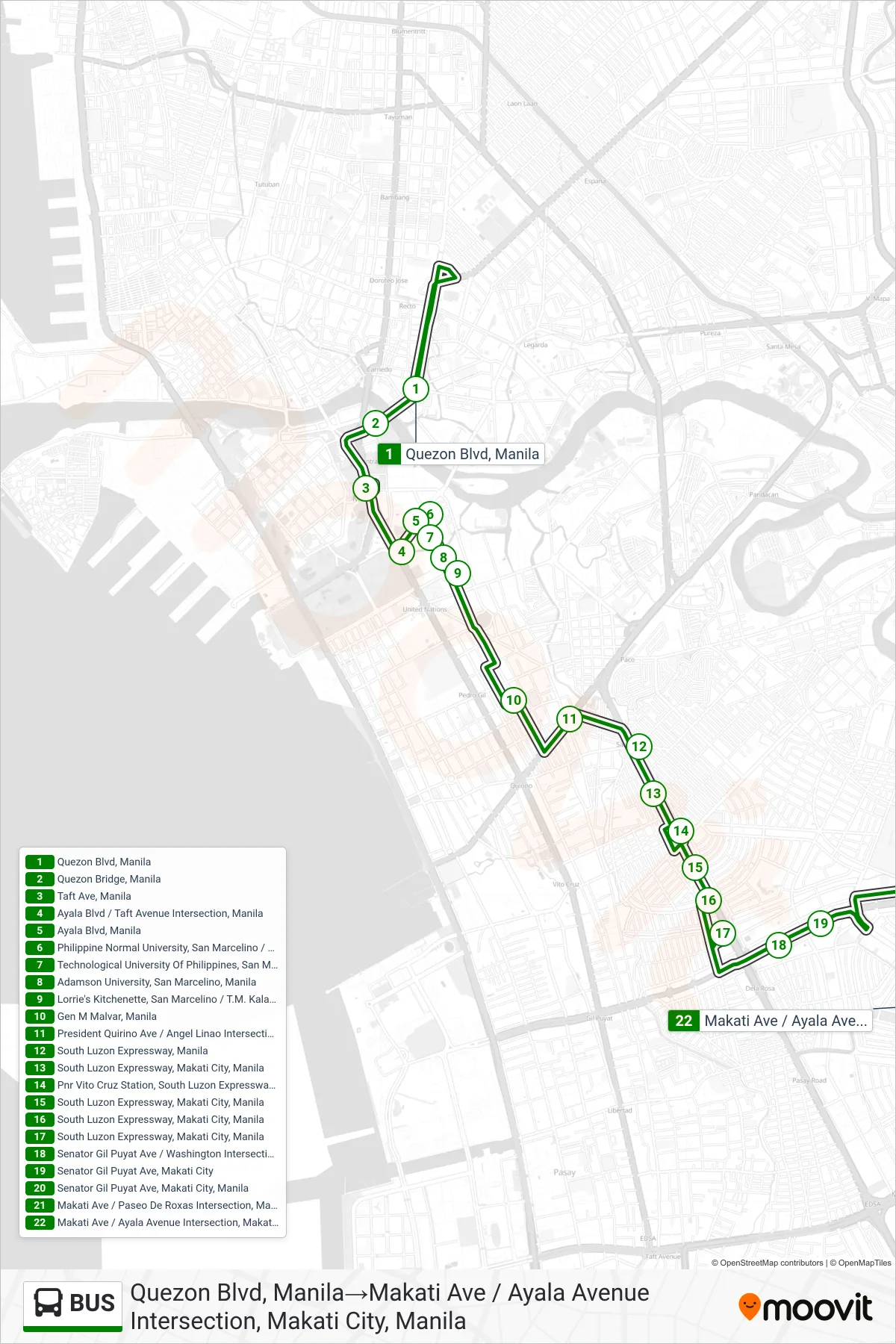
Stops list (BUS - Quezon Blvd, Manila→Makati Ave / Ayala Avenue Intersection, Makati City, Manila)
- Quezon Blvd, Manila
- Quezon Bridge, Manila
- Taft Ave, Manila
- Ayala Blvd / Taft Avenue Intersection, Manila
- Ayala Blvd, Manila
- Philippine Normal University, San Marcelino / Ayala Blvd, Manila
- Technological University Of Philippines, San Marcellino, Manila
- Adamson University, San Marcelino, Manila
- Lorrie's Kitchenette, San Marcelino / T.M. Kalaw, Manila
- Gen M Malvar, Manila
- President Quirino Ave / Angel Linao Intersection, Manila
- South Luzon Expressway, Manila
- South Luzon Expressway, Makati City, Manila
- Pnr Vito Cruz Station, South Luzon Expressway, Makati City, Manila
- South Luzon Expressway, Makati City, Manila
- South Luzon Expressway, Makati City, Manila
- South Luzon Expressway, Makati City, Manila
- Senator Gil Puyat Ave / Washington Intersection, Makati City
- Senator Gil Puyat Ave, Makati City
- Senator Gil Puyat Ave, Makati City, Manila
- Makati Ave / Paseo De Roxas Intersection, Makati City, Manila
- Makati Ave / Ayala Avenue Intersection, Makati City, Manila