
BX Train Route Map
View the BX route map and see all BX stops along the route. The map of BX shows where the train travels and the location of each stop, making it easy to understand the entire route at a glance.
Explore DSB S-tog routes on the map and see where DSB S-tog train services operate. Use the BX map to find train stations and see how the BX connects different areas along its trip.
All BX stops on the map are displayed in route order, helping you follow the BX train from the first station to the last.
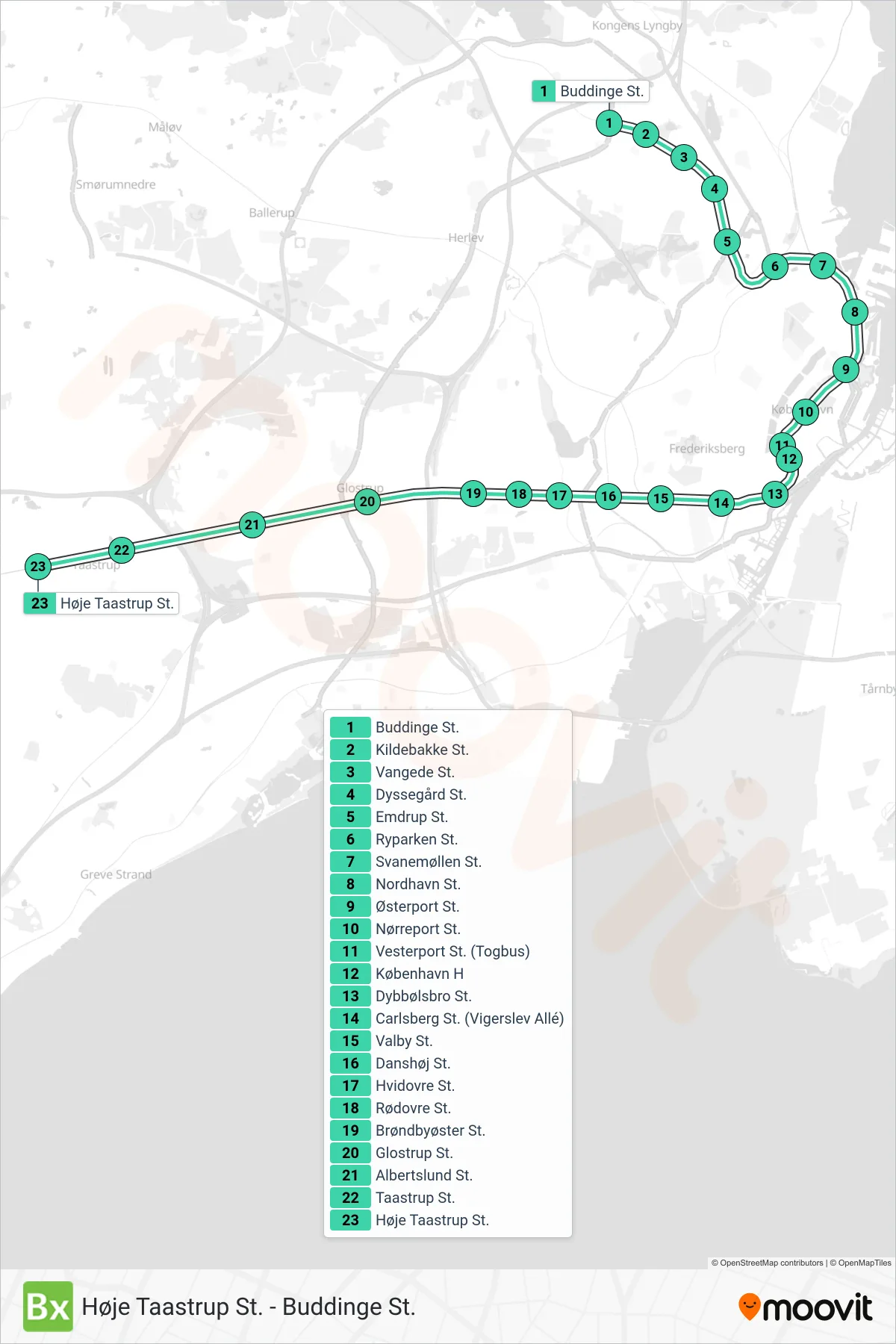
Stops list (BX - Høje Taastrup St.)
- Buddinge St.
- Kildebakke St.
- Vangede St.
- Dyssegård St.
- Emdrup St.
- Ryparken St.
- Svanemøllen St.
- Nordhavn St.
- Østerport St.
- Nørreport St.
- Vesterport St. (Togbus)
- København H
- Dybbølsbro St.
- Carlsberg St. (Vigerslev Allé)
- Valby St.
- Danshøj St.
- Hvidovre St.
- Rødovre St.
- Brøndbyøster St.
- Glostrup St.
- Albertslund St.
- Taastrup St.
- Høje Taastrup St.