
C Train Route Map
View the C route map and see all C stops along the route. The map of C shows where the train travels and the location of each stop, making it easy to understand the entire route at a glance.
Explore DSB S-tog routes on the map and see where DSB S-tog train services operate. Use the C map to find train stations and see how the C connects different areas along its trip.
All C stops on the map are displayed in route order, helping you follow the C train from the first station to the last.
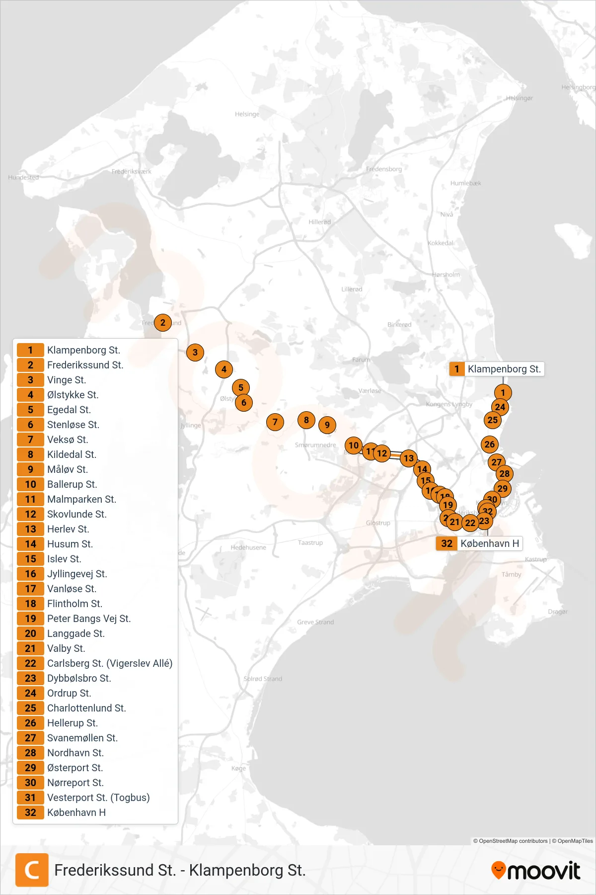
Stops list (C - København H)
- Klampenborg St.
- Frederikssund St.
- Vinge St.
- Ølstykke St.
- Egedal St.
- Stenløse St.
- Veksø St.
- Kildedal St.
- Måløv St.
- Ballerup St.
- Malmparken St.
- Skovlunde St.
- Herlev St.
- Husum St.
- Islev St.
- Jyllingevej St.
- Vanløse St.
- Flintholm St.
- Peter Bangs Vej St.
- Langgade St.
- Valby St.
- Carlsberg St. (Vigerslev Allé)
- Dybbølsbro St.
- Ordrup St.
- Charlottenlund St.
- Hellerup St.
- Svanemøllen St.
- Nordhavn St.
- Østerport St.
- Nørreport St.
- Vesterport St. (Togbus)
- København H