
C Bus Route Map
View the C route map and see all C stops along the route. The map of C shows where the bus travels and the location of each stop, making it easy to understand the entire route at a glance.
Explore Nordsachsen Mobil routes on the map and see where Nordsachsen Mobil bus services operate. Use the C map to find bus stops and see how the C connects different areas along its trip.
All C stops on the map are displayed in route order, helping you follow the C bus from the first stop to the last.
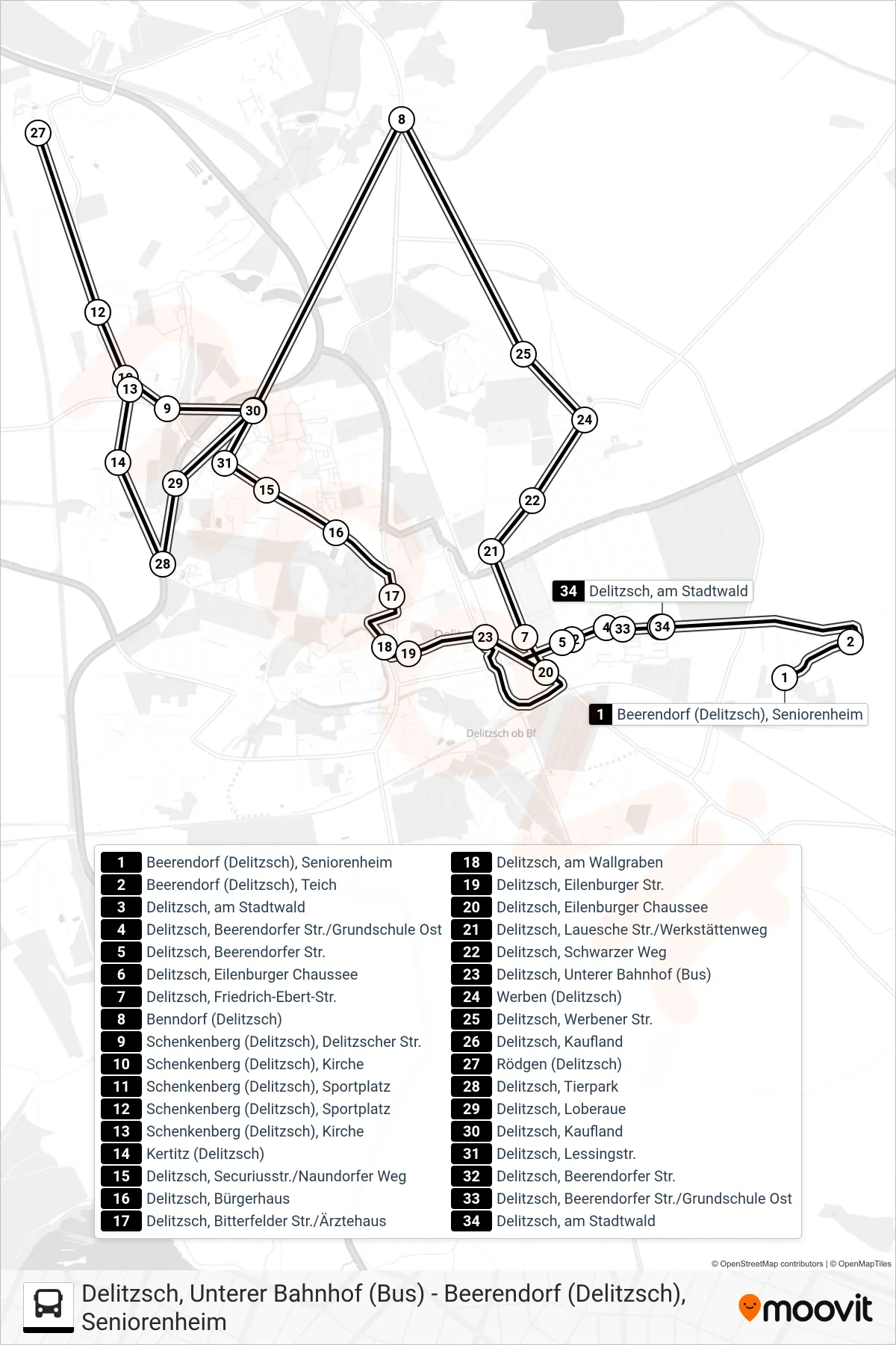
Stops list (C - Unterer Bahnhof)
- Beerendorf (Delitzsch), Seniorenheim
- Beerendorf (Delitzsch), Teich
- Delitzsch, am Stadtwald
- Delitzsch, Beerendorfer Str./Grundschule Ost
- Delitzsch, Beerendorfer Str.
- Delitzsch, Eilenburger Chaussee
- Delitzsch, Friedrich-Ebert-Str.
- Benndorf (Delitzsch)
- Schenkenberg (Delitzsch), Delitzscher Str.
- Schenkenberg (Delitzsch), Kirche
- Schenkenberg (Delitzsch), Sportplatz
- Schenkenberg (Delitzsch), Sportplatz
- Schenkenberg (Delitzsch), Kirche
- Kertitz (Delitzsch)
- Delitzsch, Securiusstr./Naundorfer Weg
- Delitzsch, Bürgerhaus
- Delitzsch, Bitterfelder Str./Ärztehaus
- Delitzsch, am Wallgraben
- Delitzsch, Eilenburger Str.
- Delitzsch, Eilenburger Chaussee
- Delitzsch, Lauesche Str./Werkstättenweg
- Delitzsch, Schwarzer Weg
- Delitzsch, Unterer Bahnhof (Bus)
- Werben (Delitzsch)
- Delitzsch, Werbener Str.
- Delitzsch, Kaufland
- Rödgen (Delitzsch)
- Delitzsch, Tierpark
- Delitzsch, Loberaue
- Delitzsch, Kaufland
- Delitzsch, Lessingstr.
- Delitzsch, Beerendorfer Str.
- Delitzsch, Beerendorfer Str./Grundschule Ost
- Delitzsch, am Stadtwald