
C Bus Route Map
View the C route map and see all C stops along the route. The map of C shows where the bus travels and the location of each stop, making it easy to understand the entire route at a glance.
Explore Astuce (Métropole Rouen Normandie) routes on the map and see where Astuce (Métropole Rouen Normandie) bus services operate. Use the C map to find bus stops and see how the C connects different areas along its trip.
All C stops on the map are displayed in route order, helping you follow the C bus from the first stop to the last.
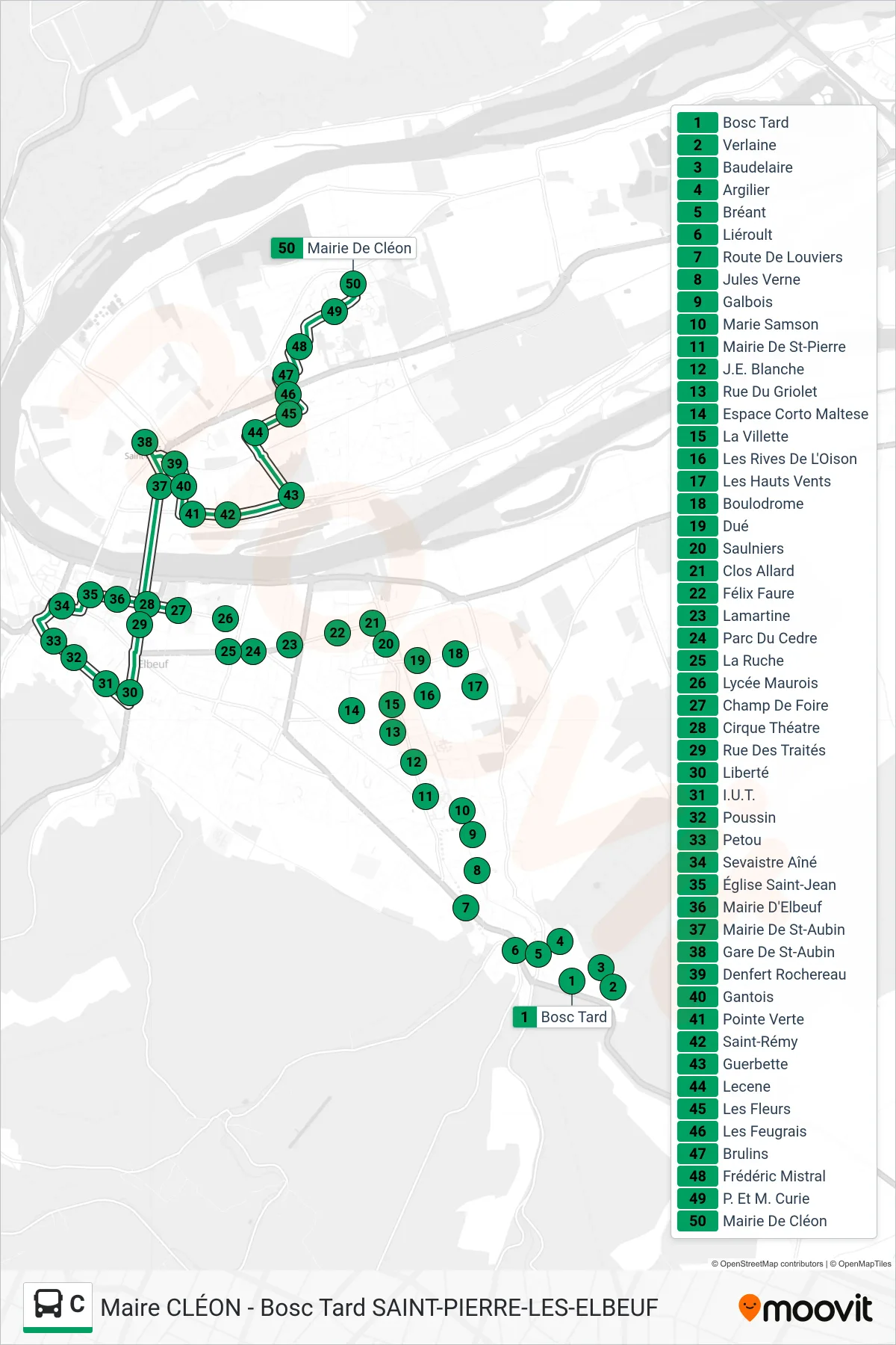
Stops list (C - Mairie De Cléon)
- Bosc Tard
- Verlaine
- Baudelaire
- Argilier
- Bréant
- Liéroult
- Route De Louviers
- Jules Verne
- Galbois
- Marie Samson
- Mairie De St-Pierre
- J.E. Blanche
- Rue Du Griolet
- Espace Corto Maltese
- La Villette
- Les Rives De L'Oison
- Les Hauts Vents
- Boulodrome
- Dué
- Saulniers
- Clos Allard
- Félix Faure
- Lamartine
- Parc Du Cedre
- La Ruche
- Lycée Maurois
- Champ De Foire
- Cirque Théatre
- Rue Des Traités
- Liberté
- I.U.T.
- Poussin
- Petou
- Sevaistre Aîné
- Église Saint-Jean
- Mairie D'Elbeuf
- Mairie De St-Aubin
- Gare De St-Aubin
- Denfert Rochereau
- Gantois
- Pointe Verte
- Saint-Rémy
- Guerbette
- Lecene
- Les Fleurs
- Les Feugrais
- Brulins
- Frédéric Mistral
- P. Et M. Curie
- Mairie De Cléon