
C Bus Route Map
View the C route map and see all C stops along the route. The map of C shows where the bus travels and the location of each stop, making it easy to understand the entire route at a glance.
Explore Cap Cotentin (Cherbourg, Agglo. du Cotentin) routes on the map and see where Cap Cotentin (Cherbourg, Agglo. du Cotentin) bus services operate. Use the C map to find bus stops and see how the C connects different areas along its trip.
All C stops on the map are displayed in route order, helping you follow the C bus from the first stop to the last.
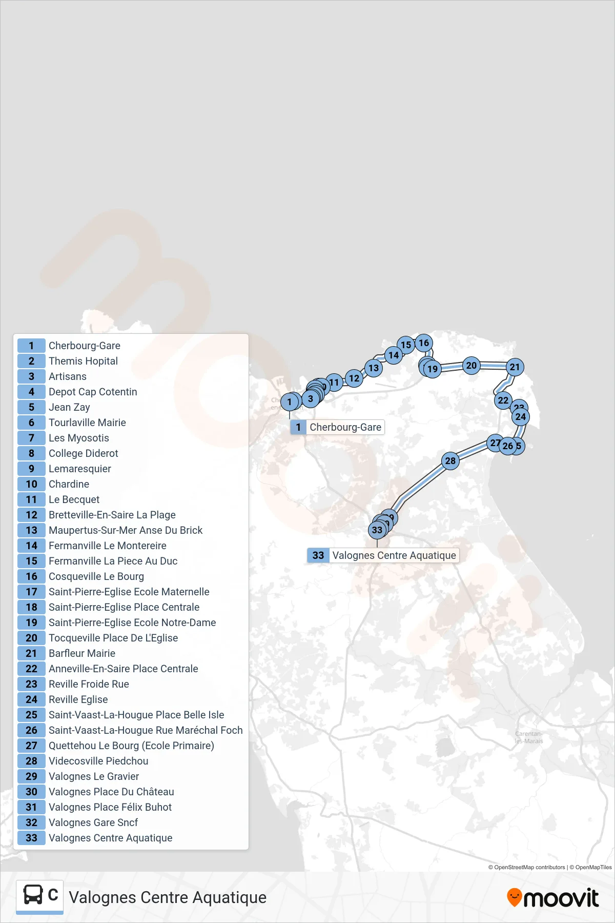
Stops list (C - Valognes Centre Aquatique)
- Cherbourg-Gare
- Themis Hopital
- Artisans
- Depot Cap Cotentin
- Jean Zay
- Tourlaville Mairie
- Les Myosotis
- College Diderot
- Lemaresquier
- Chardine
- Le Becquet
- Bretteville-En-Saire La Plage
- Maupertus-Sur-Mer Anse Du Brick
- Fermanville Le Montereire
- Fermanville La Piece Au Duc
- Cosqueville Le Bourg
- Saint-Pierre-Eglise Ecole Maternelle
- Saint-Pierre-Eglise Place Centrale
- Saint-Pierre-Eglise Ecole Notre-Dame
- Tocqueville Place De L'Eglise
- Barfleur Mairie
- Anneville-En-Saire Place Centrale
- Reville Froide Rue
- Reville Eglise
- Saint-Vaast-La-Hougue Place Belle Isle
- Saint-Vaast-La-Hougue Rue Maréchal Foch
- Quettehou Le Bourg (Ecole Primaire)
- Videcosville Piedchou
- Valognes Le Gravier
- Valognes Place Du Château
- Valognes Place Félix Buhot
- Valognes Gare Sncf
- Valognes Centre Aquatique