
C1 Bus Route Map
View the C1 route map and see all C1 stops along the route. The map of C1 shows where the bus travels and the location of each stop, making it easy to understand the entire route at a glance.
Explore Cilia Italia Srl routes on the map and see where Cilia Italia Srl bus services operate. Use the C1 map to find bus stops and see how the C1 connects different areas along its trip.
All C1 stops on the map are displayed in route order, helping you follow the C1 bus from the first stop to the last.
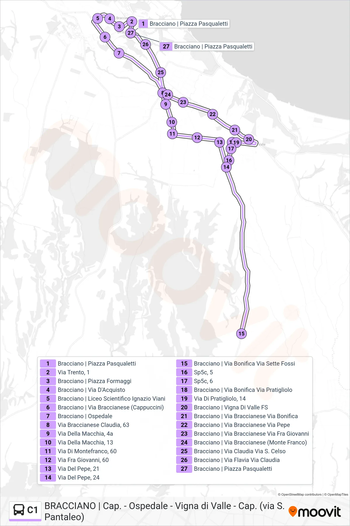
Stops list (C1 - Hospital > San Pantaleo > Vigna Di Valle)
- Bracciano | Pasqualetti Square
- Trento Street, 1
- Bracciano | Cheese Square
- Bracciano | Via D'Acquisto
- Bracciano | Ignazio Viani Scientific High School
- Bracciano | Braccianese Street (Cappuccini)
- Bracciano Hospital
- Braccianese Claudia St, 63
- Macchia Street, 4a
- Macchia Street, 13
- Montefranco Street, 60
- 60 Fra Giovanni Street
- Pepper Street, 21
- Pepper Street, 24
- Bracciano | Bonifica Road Sette Fossi Road
- Sp5c, 5
- Sp5c, 6
- Bracciano | Bonifica Street Pratigliolo Street
- 14 Pratigliolo Road
- Bracciano | Vigna di Valle Station
- Bracciano | Braccianese Street Bonifica Street
- Bracciano | Braccianese Road Pepe Street
- Bracciano | Braccianese Road Fra Giovanni Road
- Bracciano | Braccianese Street (Monte Franco)
- Bracciano | Via Claudia Via S. Celso
- Bracciano | Flavia Street Claudia Street
- Bracciano | Pasqualetti Square