
C203 Tram Route Map
View the C203 route map and see all C203 stops along the route. The map of C203 shows where the tram travels and the location of each stop, making it easy to understand the entire route at a glance.
Explore routes on the map and see where tram services operate. Use the C203 map to find tram stations and see how the C203 connects different areas along its trip.
All C203 stops on the map are displayed in route order, helping you follow the C203 tram from the first station to the last.
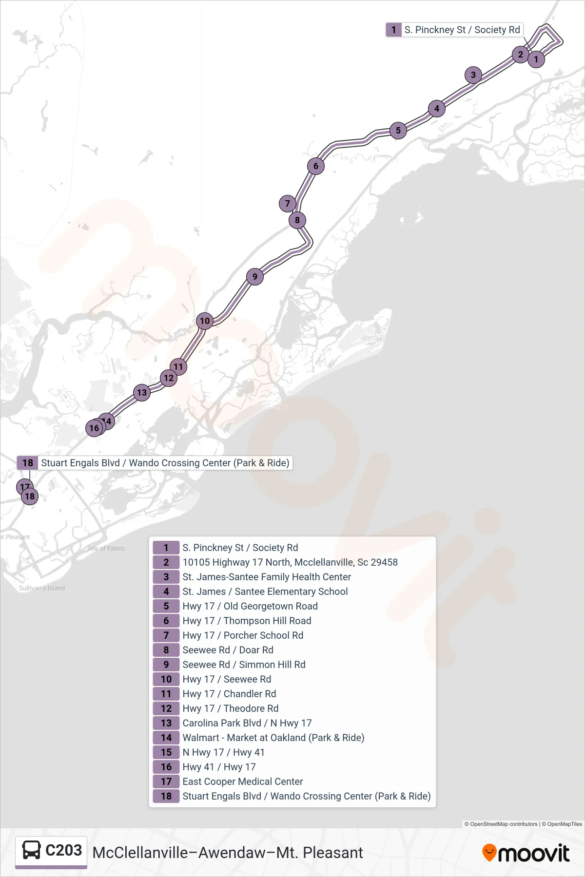
Stops list (C203 - Mt. Pleasant)
- S. Pinckney St / Society Rd
- 10105 Highway 17 North, Mcclellanville, Sc 29458
- St. James-Santee Family Health Center
- St. James / Santee Elementary School
- Hwy 17 / Old Georgetown Road
- Hwy 17 / Thompson Hill Road
- Hwy 17 / Porcher School Rd
- Seewee Rd / Doar Rd
- Seewee Rd / Simmon Hill Rd
- Hwy 17 / Seewee Rd
- Hwy 17 / Chandler Rd
- Hwy 17 / Theodore Rd
- Carolina Park Blvd / N Hwy 17
- Walmart - Market at Oakland (Park & Ride)
- N Hwy 17 / Hwy 41
- Hwy 41 / Hwy 17
- East Cooper Medical Center
- Stuart Engals Blvd / Wando Crossing Center (Park & Ride)