
C35 Bus Route Map
View the C35 route map and see all C35 stops along the route. The map of C35 shows where the bus travels and the location of each stop, making it easy to understand the entire route at a glance.
Explore WMATA routes on the map and see where WMATA bus services operate. Use the C35 map to find bus stops and see how the C35 connects different areas along its trip.
All C35 stops on the map are displayed in route order, helping you follow the C35 bus from the first stop to the last.
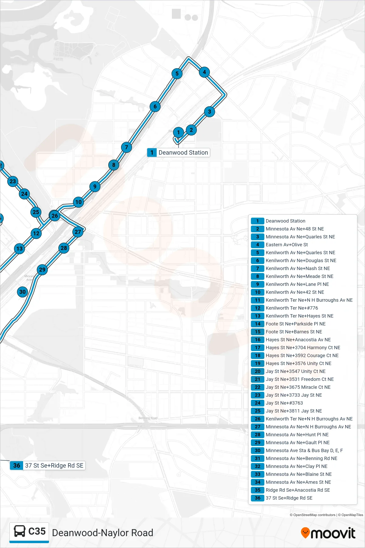
Stops list (C35 - South To Fort Dupont)
- Deanwood Station
- Minnesota Av Ne+48 St NE
- Minnesota Av Ne+Quarles St NE
- Eastern Av+Olive St
- Kenilworth Av Ne+Quarles St NE
- Kenilworth Av Ne+Douglas St NE
- Kenilworth Av Ne+Nash St NE
- Kenilworth Av Ne+Meade St NE
- Kenilworth Av Ne+Lane Pl NE
- Kenilworth Av Ne+42 St NE
- Kenilworth Ter Ne+N H Burroughs Av NE
- Kenilworth Ter Ne+#776
- Kenilworth Ter Ne+Hayes St NE
- Foote St Ne+Parkside Pl NE
- Foote St Ne+Barnes St NE
- Hayes St Ne+Anacostia Av NE
- Hayes St Ne+3704 Harmony Ct NE
- Hayes St Ne+3592 Courage Ct NE
- Hayes St Ne+3576 Unity Ct NE
- Jay St Ne+3547 Unity Ct NE
- Jay St Ne+3531 Freedom Ct NE
- Jay St Ne+3675 Miracle Ct NE
- Jay St Ne+3733 Jay St NE
- Jay St Ne+#3763
- Jay St Ne+3811 Jay St NE
- Kenilworth Ter Ne+N H Burroughs Av NE
- Minnesota Av Ne+N H Burroughs Av NE
- Minnesota Av Ne+Hunt Pl NE
- Minnesota Av Ne+Gault Pl NE
- Minnesota Ave Sta & Bus Bay D, E, F
- Minnesota Av Ne+Benning Rd NE
- Minnesota Av Ne+Clay Pl NE
- Minnesota Av Ne+Blaine St NE
- Minnesota Av Ne+Ames St NE
- Ridge Rd Se+Anacostia Rd SE
- 37 St Se+Ridge Rd SE